Over time, Musgrave Park in South Brisbane has been perceived in many different ways, reflecting changes both in our society and in the demographics of the surrounding area. Come with me on a journey through the history of the park.
Before European Settlement
The site of today’s Musgrave Park lay for untold millennia within a relatively highly populated area. Large numbers of visitors from surrounding districts frequently came to the central Brisbane area for ceremonies.
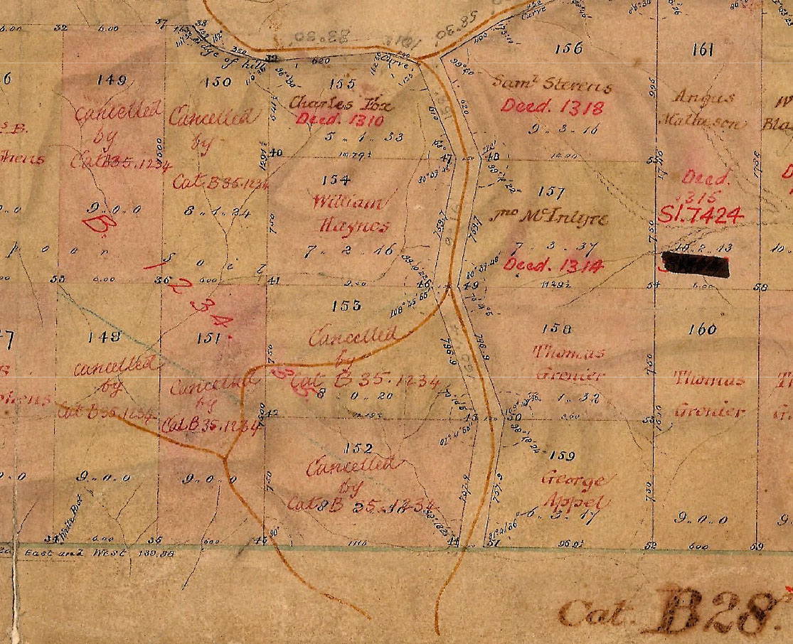
This extract from Surveyor Galloway’s 1855 map shows Aboriginal pathways descending from Highgate Hill to the Musgrave Park area. The location of Brisbane State High School is at centre bottom. (Plan B1234.28 Sheet 1, Museum of Lands, Mapping and Surveying Queensland)
The higher portion of what was to become the park was part of an habitual camping area that stretched along a ridge roughly aligned with Vulture Street as far as the Mater Hospital. A recollection from 1915 written by William Clark describes Aboriginal people ‘camped in their bark and bough gunyas under the trees at the foot of Highgate Hill, and on the slanting sides of Cumbooquepa”.
The camp was still in use at least as late as 1855, as is suggested in the painting by Thomas Baines of the view from the vicinity of Dorchester Street.
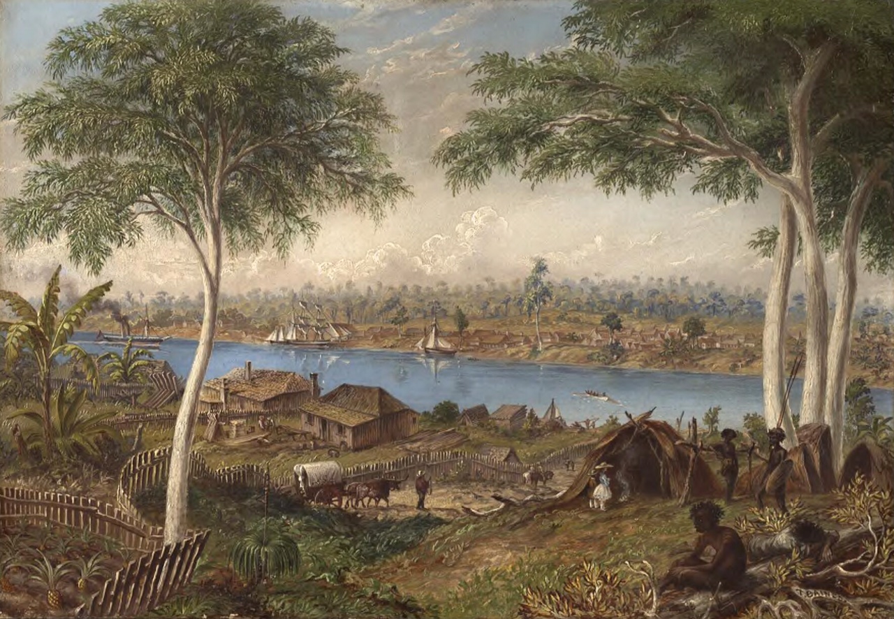
“South Brisbane , Moreton Bay, Australia” Thomas Baines 1868, from a sketch made July, 1855. (National Library of Australia)
The low lying part of the park to the north included a gully and a water hole. Before urban development took place, numerous creeks flowed down from Highgate Hill after rain, feeding the swampy area that constituted much of South Brisbane (see my post Kurilpa – Water, Water, Everywhere ). This and the surrounding rainforest along the river and the nearby hills were plentiful hunting grounds.
One local oral tradition has it that the area around the current swimming pool was a women’s place used for the initiation of girls reaching puberty.
There were memories of a bora ring in the park being used into the 1870s. It’s not certain whether this was a pre-existing bora ring or a new one built as ancient ones were located on land no longer accessible (see for example my Post Holy Hawthorne Street). Axe heads and stone scrapers have been found in the vicinity of the park.
As the only public space left in South Brisbane after European development, the ground that would become Musgrave Park continued to be a gathering area for Aboriginal people.
The Recreation Reserve
The map extract below dating from 1858 shows the South Brisbane Recreation Reserve, as the park was then known, lying inside the red town boundary, but beyond the limit of suburban subdivision at that time.
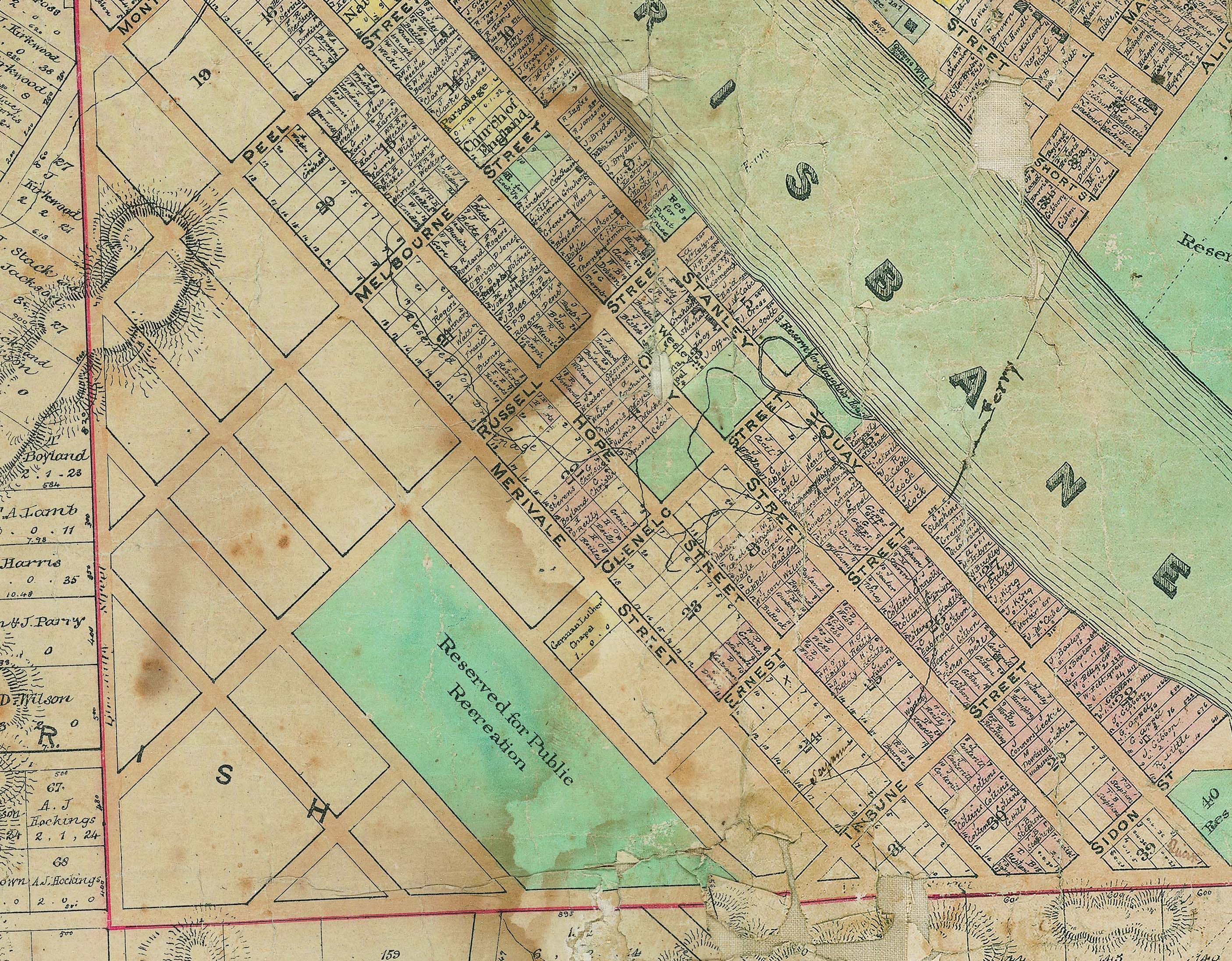
The Recreation Reserve that would become Musgrave Park, 1858. It was inside the town boundary, shown in red. (Brisbane City Council Archives)
The Queensland Gazette of 1865 records the nomination of the initial trustees of the reserve as T. B. Stephens ( South Brisbane War Memorial Park and the Disappearing Ridge ), W. T. Blakeney ( The Blakeneys of Highgate Hill ), Samuel Stevens and William Baynes.
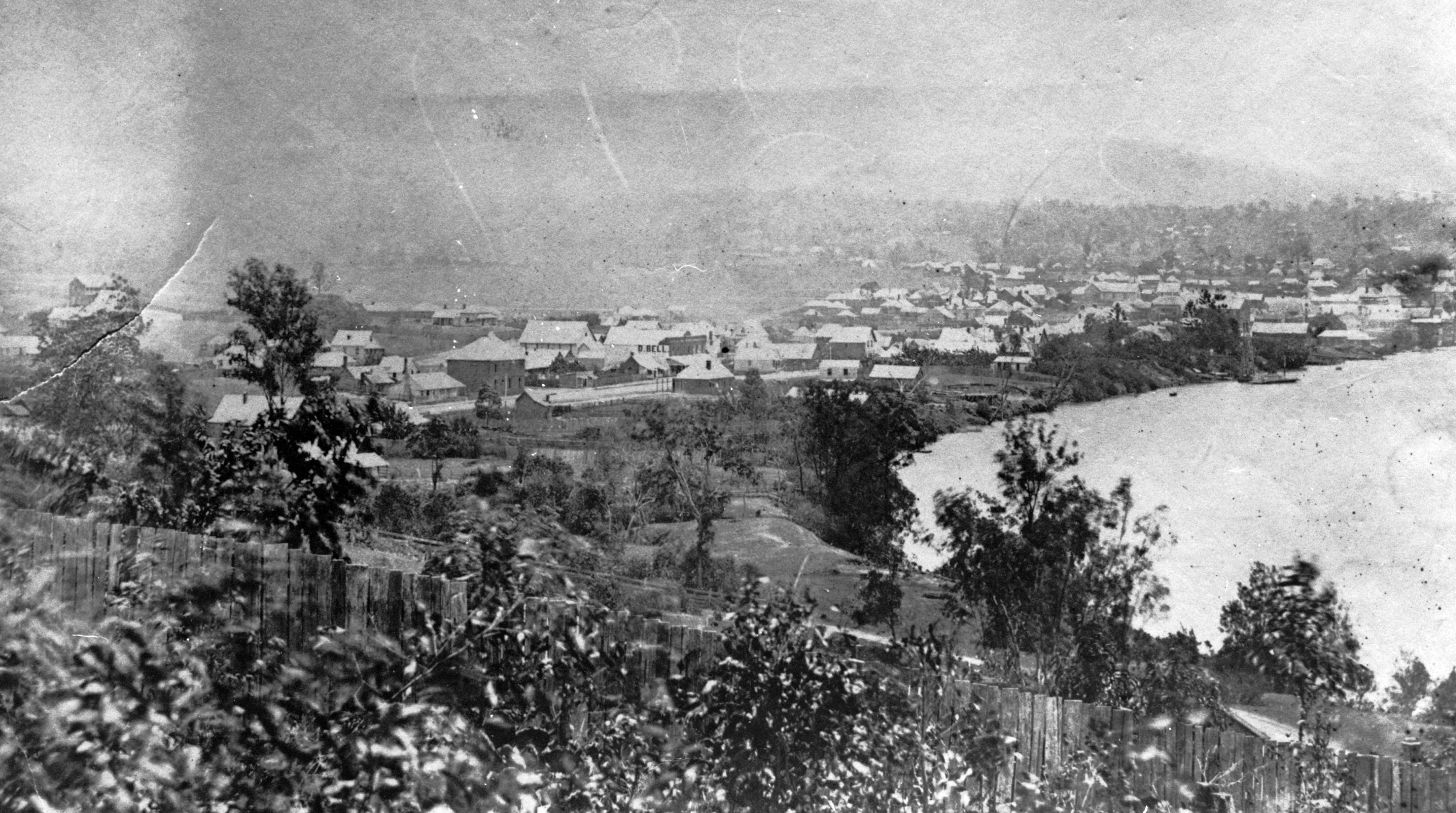
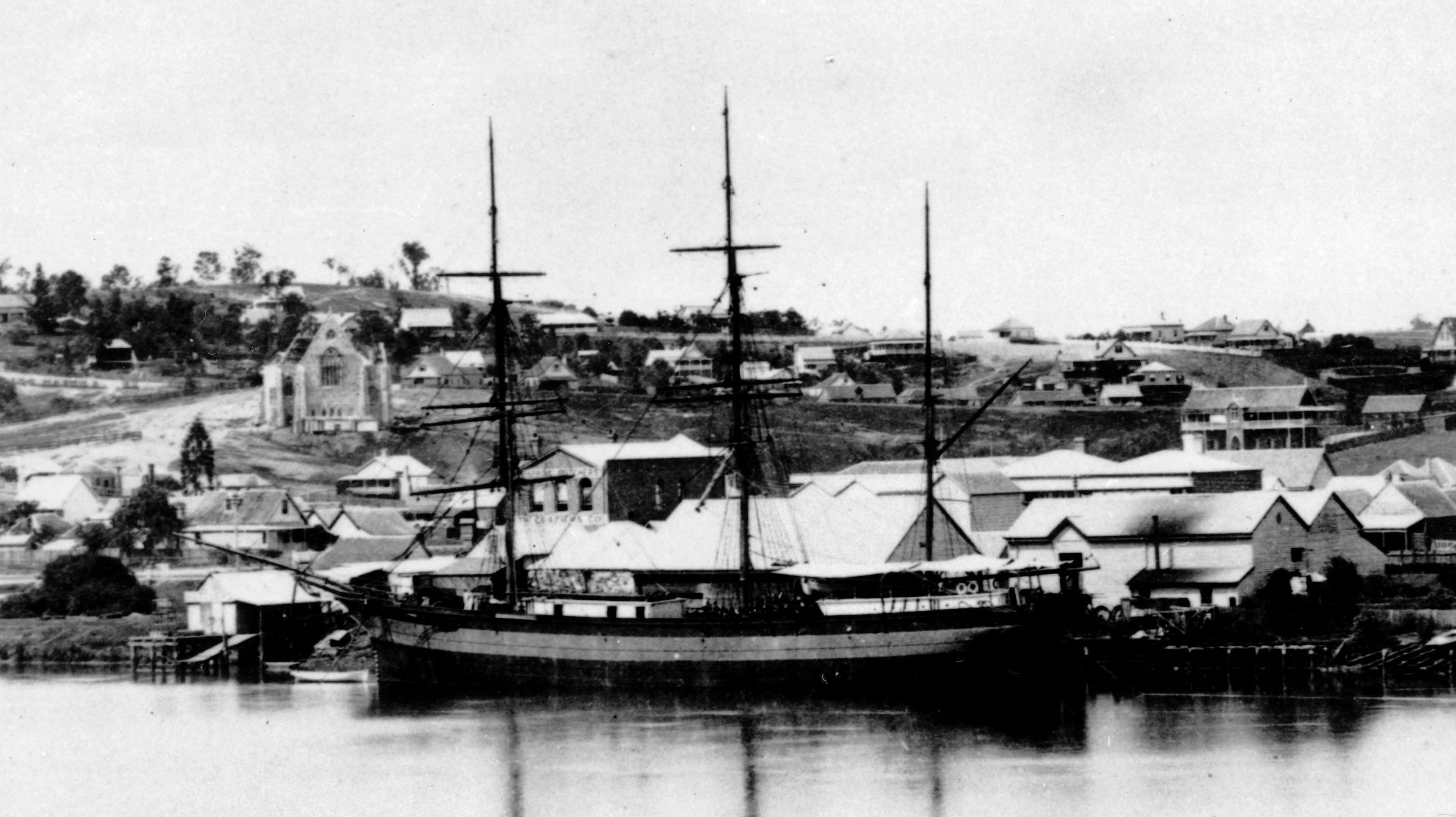
South Brisbane in 1868. The Recreation Reserve is in the centre of the photo, beyond the line of houses. (State Library of Queensland)
In the 1860s, many immigrants arrived at the wharves of South Brisbane and were allowed to stay for up to a month in primitive immigration depots such as the one located at today’s Southbank. Overflow accommodation was in Government supplied tents erected in various locations around town. Between 1864 and 1868 the population of Queensland jumped from 61,000 to almost 100,000, largely fueled by immigration.
Over 10,000 arrived in 1863 alone, with the majority arriving in Brisbane. Tent accommodation was arranged on the high part of the Recreation Reserve. In October of that year, which saw heavy rainfall, one commentator described the “miseries endured in those torn and tattered tents which neither wind proof nor water proof disfigure the environs of our town”. There were insufficient tents and some families had to shelter from the rain under trees. Others made makeshift humpies.

South Brisbane in the 1860s. In the background on the left can be seen immigrant tents amongst the trees in the Recreation Reserve. (State Library of Queensland)
The first piece of the reserve to be lost was the south eastern corner, adjacent to Vulture Street. The parishioners of St Thomas’ Anglican Church, which was located on Melbourne Street, wisely wanted to build a new church on higher ground free from flooding.

St Thomas’ Church at the location of the Queensland Art Gallery in Melbourne Street ca. 1874. (State Library of Queensland)
In 1875, a portion of the reserve adjoining Vulture Street was excised and sold at auction. A number of influential parishioners made this happen, including Registrar-General William Theophilus Blakeney (see my post The Blakeneys of Highgate Hill ) and Albert Hockings Albert Hockings and his “Rosaville” Nursery. Both were trustees of the reserve. Others included several judges, senior public servants and politicians.
At the auction held in October 1875, and church trustees purchased most of the land. The parish representatives were outbid on the prime block on Vulture Street by David Grayson, who it seems was against the reserve being reduced in size. He paid £130 for his block, around twice the price of the others.
This colourful character, referred to in one newspaper article as “The bumptious ex-Alderman“, had a number of run-ins with the law and was found guilty of assault and corruption whilst on the Brisbane Council. Grayson died in 1877, but the parish had to wait until 1887 to purchase the missing lot. By then, his dissolute son had came of age and inherited the land.
Meanwhile, the new church of St. Andrew, designed by Andrea Stombuco, began in 1878 on a suboptimal part of the block. The first stage was completed in 1883. For the full story, see my post The Fraught Beginnings of St Andrew’s South Brisbane
In this 1881 photo showing the upper part of the reserve, St Andrew’s Anglican Church is under construction. (State Library of Queensland)

The Queensland Rugby Union team that played NSW ca. 1883. (State Library of Queensland)
The 1870s saw the beginning of organised football games and cricket matches in the park.
Around this time a number of football clubs were established in Brisbane. In these early days, matches alternated between what we would now call Australian Rules, Rugby Union or League and Soccer. Rugby became the dominant code in the following years.
Cricket clubs had also started to multiply in Brisbane although many only lasted a few years. Many teams playing in the park such as Government Printing Office, Telegraph Operators, Hoffnung and Co. and South Brisbane Grocers were workplace based.
The reserve becomes Musgrave Park
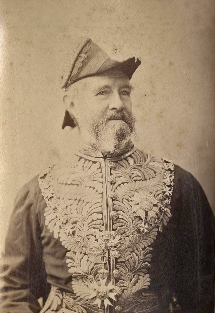
Sir Anthony Musgrave, Governor of Queensland 1883 – 1888. (State Library of Queensland)
The wheels of Colonial Government turned slowly and in 1883, 18 years after the nomination of the trustees, they finally obtained the title deeds to the land.
In the following year, it was decided to name the park in honour of the Colony’s Governor, Anthony Musgrave. He died in office 4 years later.
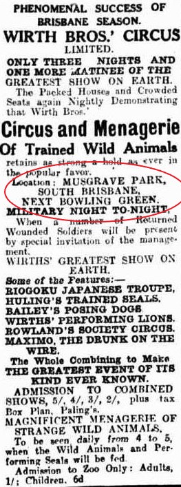
The Telegraph (Brisbane) 8th October, 1884 (TROVE).
Funding for the park was an ongoing issue, with the Colonial Government holding the purse strings and the cash strapped South Brisbane Municipality only able to provide labour. The trustees were often seeking more funding from the Minister.
Grass removal, Musgrave Park. Telegraph (Brisbane) 30 Jan. 1926. (TROVE)
Funding continued to be an issue well into the 20th century. Periods of economic difficulty such as the 1890s and 1930s inevitably led to complaints of the park being unkempt and overgrown with tall weeds.
In 1885, there was some discussion in letters to the editor regarding the terrible smell emanating from the park, described by one correspondent as a “municipal stinkpot”. The dumping of rubbish was commonplace. Also slush water from houses in Edmondstone Street ran into the park and contributed to the stench.
There had been some development with trees and gardens. In 1889, the theft of flowers and bushes got to the point at which a guard was stationed in the park. He apprehended two young women who were picking flowers but they were let off after pleading ignorance of the rules!
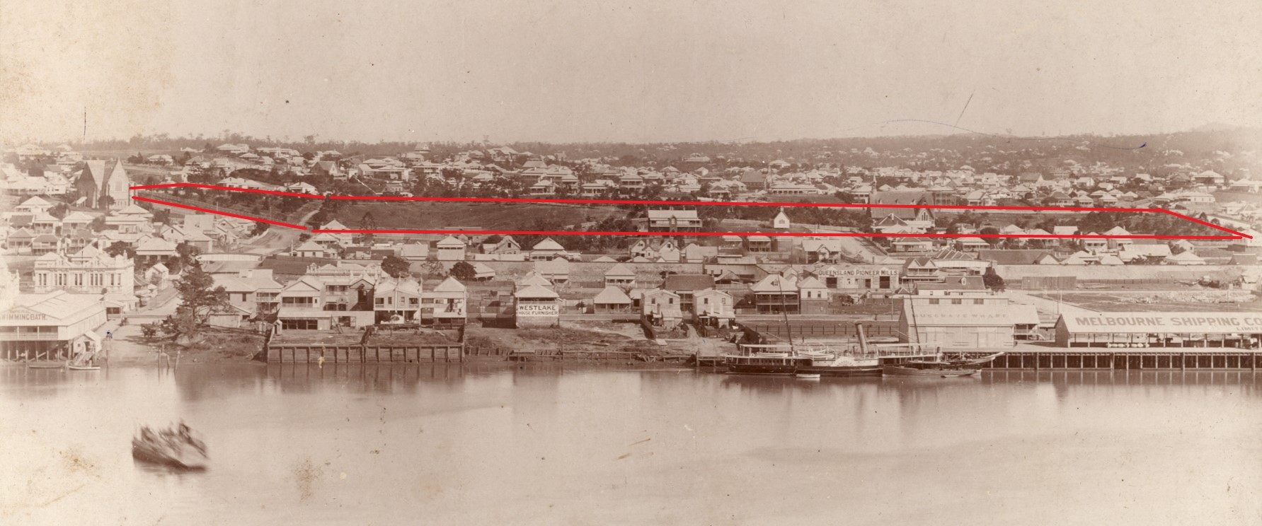
A view of South Brisbane ca 1884. I’ve outlined Musgrave Park in red. The suburb of West End has sprung up beyond the park. (Fryer Library UQ)
The park also was occupied by homeless people, in a time with little in the way of social assistance. Following a period of high immigration driven by Government marketing in Britain and subsidies for travel, the Queensland economy stagnated in the late 1880s before slipping into a prolonged recession in the next decade. Unemployment was on the rise.
Queensland Figaro and Punch, 21st August 1886. (TROVE)
In 1888, for example, there was a report of a woman living in the park who early in the morning stole milk from the delivery man and house verandahs. The South Brisbane Council passed a by-law legalizing the removal of ‘undesirable persons’ and forbade camping. Often the homeless were arrested for vagrancy.
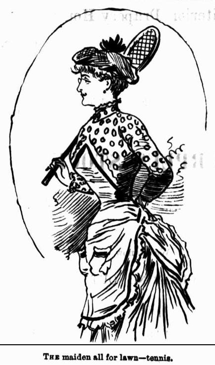
Despite all of this, Musgrave Park’s role as a major sports venue, that was to continue for over 100 years, was increasing. The South Brisbane Lawn Tennis Club based in the park was founded in 1886 with both male and female members. Tennis was one of the few sports deemed socially acceptable for women at the time (see my post Tennis).
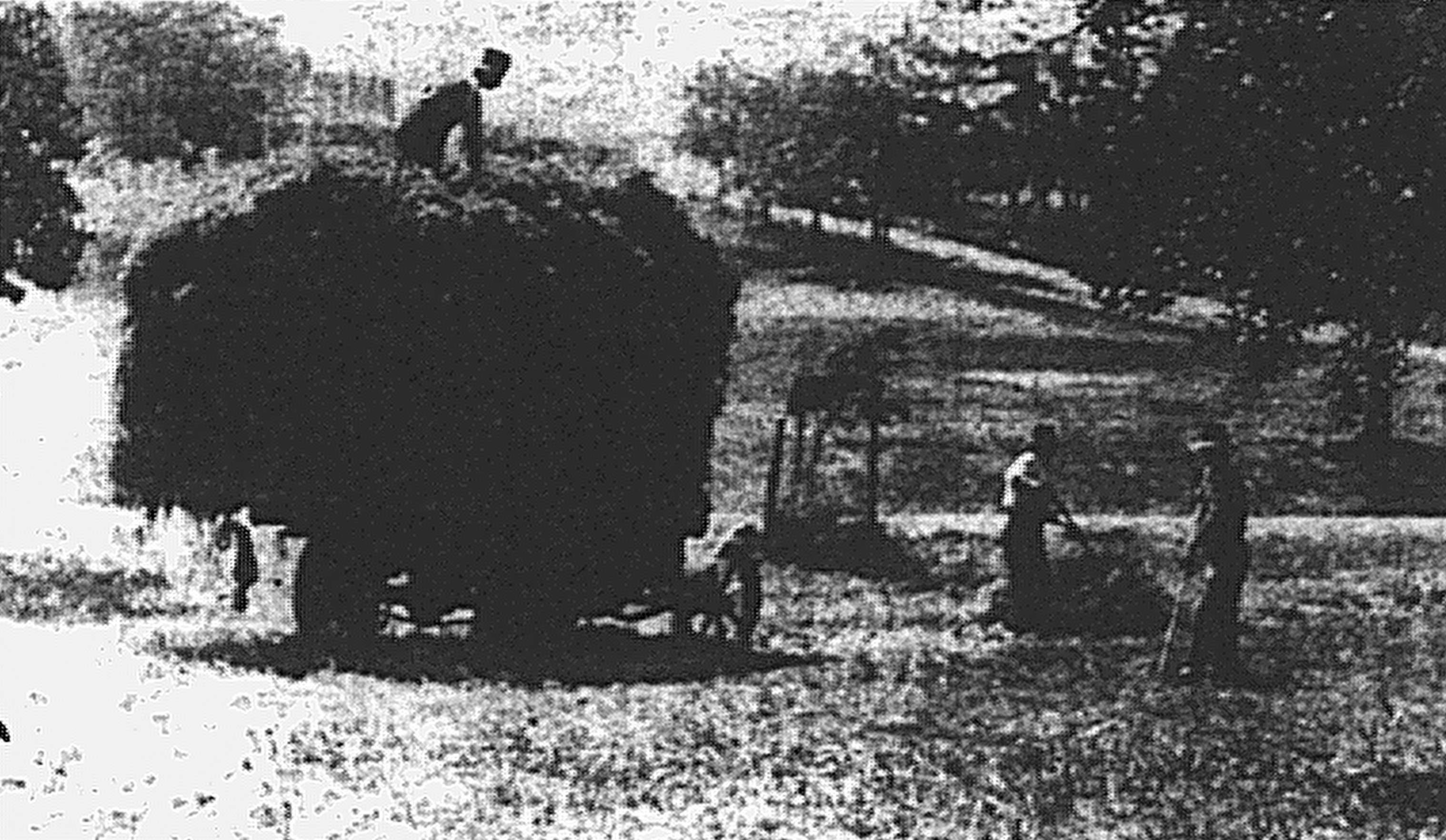
Some work was done to fill in low parts of the park, but there was still a large gully where children swam after rain. A letter published in the Brisbane Courier in 1927 mentions that an old cricket pitch lay 3 to 4 feet (about a metre) below the current one and that a water hole was once located near to this location.
In the great flood of 1893, about half of the park was inundated along with most of South Brisbane.

The northern end of Musgrave Park viewed from Edmondston Street during the 1893 flood . (Fryer Library UQ)
This was also a period of increasing prestige of the surrounding area. Fine houses were built on Edmondstone Street facing the park. A few survive, such as the heritage listed Brighton and Kemptown, Staigersleigh and The Quinta .


A New Century
The new century saw the park’s heyday as a social venue.
Telegraph (Brisbane) 9 May 1930 (TROVE)
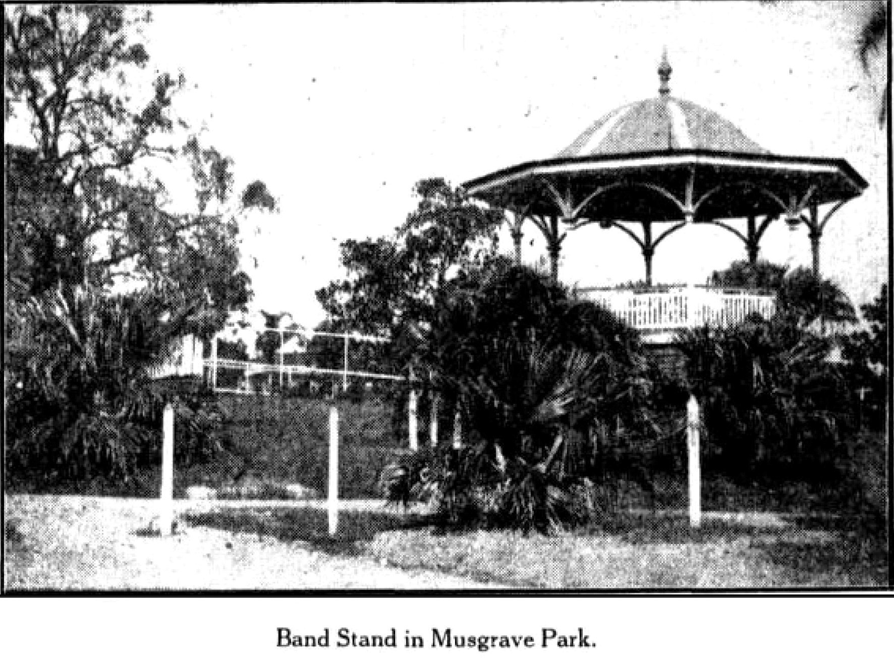
Band concerts had been held for some time, and towards the end of 1901 a bandstand was erected, paid for in large part through public donations.
It was located on a high point of the park, at the rear of the present swimming pool grounds. Well attended concerts would become a feature of the park until around 1920 when they seem to have petered out.
The park was illuminated at night by electric light with decorative lighting on the band stand. Two new tennis courts were constructed by community groups.
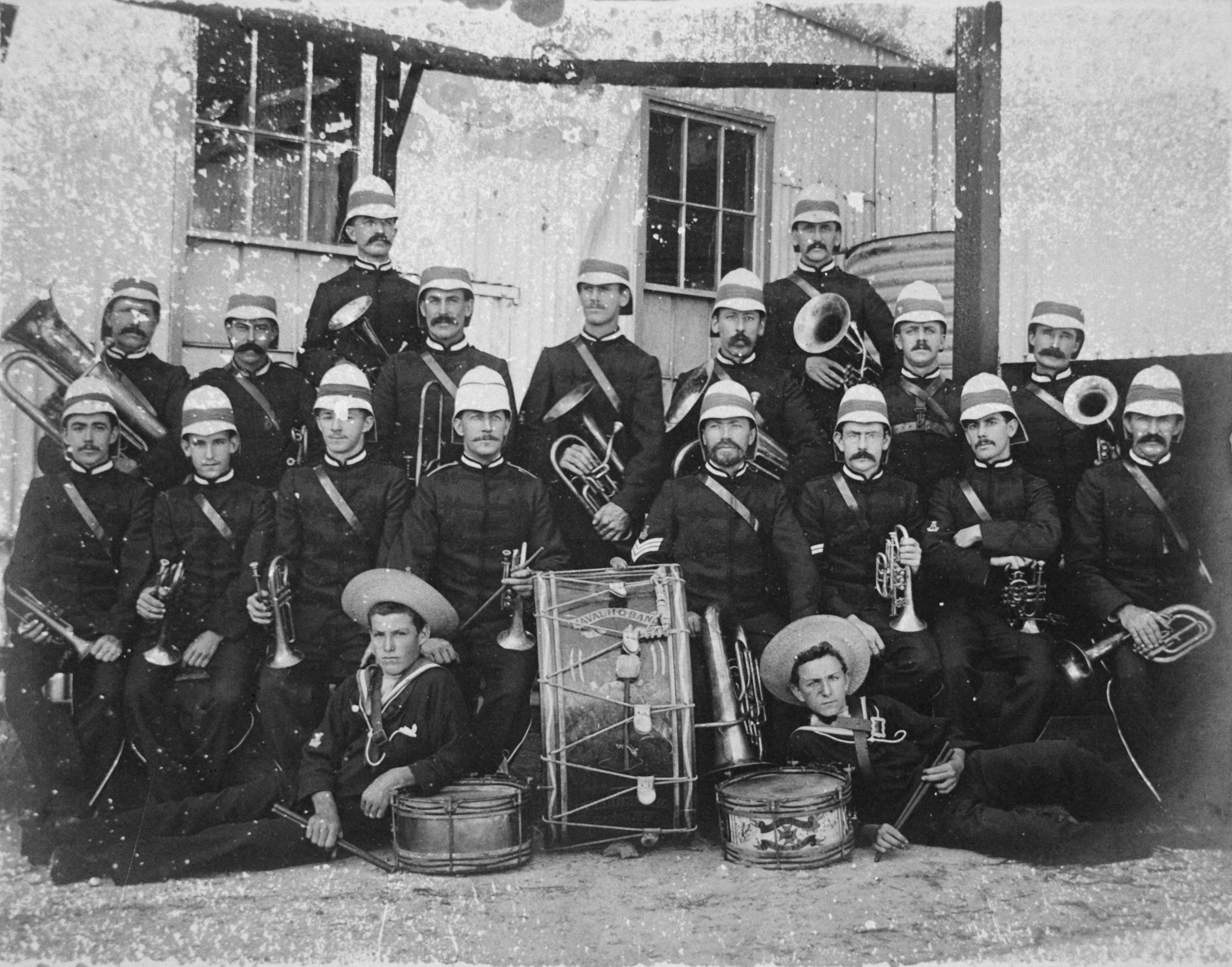
The Naval Reserve Band, here pictured in 1901, often gave mid-week concerts in the cool of the evening in Musgrave Park. (State Library of Queensland)
The South Brisbane Bowling Club was founded in 1900. Two years later, the greens were inaugurated. They were built at a cost of £400 using soil from the river bank at West End. The clubhouse was built in stages from 1907. A building was moved from New Farm in 1924.

South Brisbane Bowls Club 1909. (State Library of Queensland)
In 1903, a group of local women including Josephine Papi, who served as secretary (see Ferdinand and Josephine Papi – an Edwardian Power Couple ), founded the South Brisbane Croquet Club. Croquet was a very popular game at the time and larger houses often had a lawn on their property. See for example my post Mon Abri – Brighton Road .

Queensland Figaro, 18th June 1903. (TROVE).
At the time, fashion on the lawns seemed to play an important role and the Figaro article covering the opening day has over two pages of descriptions of the attire of the attendees. Amongst them was Lydia Hopkins, one of the family living in our house at the time (see Glenview – A Highgate Hill House circa 1883 ).

Croquet players with extravagant hats in Musgrave Park, 1911. Behind them is a tennis court, bowls club and St Andrews Church. (State Library of Queensland colourised by My Heritage)
Below on the left are prizewinners in the State Championships held at Musgrave Park with Josephine Papi seated on the right. The other image is of a mixed doubles contest. Both are from 1911.


Daily Mail, 26 July 1917. (TROVE)
One tongue in cheek article from 1903 gives an insight into the park’s prestige at this time. “On one of its eminences is the bowling green, the resort of the elite of the southern half of the metropolis, and alongside, another square of turf on which the wives and daughters of aldermen and others disport themselves at croquet.”
The park was subject to “mixed usage”. The surrounding area was heavily populated and during the day usually filled with children, accompanied by their mothers or nurses. One correspondent in a 1912 letter to the editor complains of the number of prostitutes soliciting close to children, as the publicly accessible part of the park had been much reduced by fenced in areas around the various sporting clubs.
Despite its great popularity, there were still problems in parts of the park with the dumping of rubbish resulting in “a deadly smell permeating adjoining residences”. Even the local jam factory was accused of dumping waste.
To allow easier access, in 1911 the gates to the fully fenced park were removed. However this led to a problem with cyclists creating a nuisance by speeding through dangerously as well as wandering cattle. The gates were reinstated.

A game of tennis in Musgrave Park ca 1913. In the background is the bandstand. This court was located near today;s swimming pool. (Taylor collection, Fryer Library, UQ)
Community Gatherings
As well as all of these activities, there were increasing instances of community gatherings such as Sunday School picnics. These had previously been held in nearby vacant paddocks that were rapidly disappearing with urban development.
Typical was one June weekend in 1914 when two groups shared the available free space. The Hill End Methodist Mission previously had used O’Reilly’s paddock off Dornoch Terrace but it had been recently subdivided (see my post Toonarbin ) and they had their picnic in Musgrave Park. Also, two hundred and fifty members of the West End Gospel Mission marched to the park from their hall in Boundary Street, now the Greek Evangelical Church, behind a large banner proclaiming “God is Love”. These sorts of gatherings in Musgrave Park would continue until 1950s when transport to rural venues became more affordable and practical.
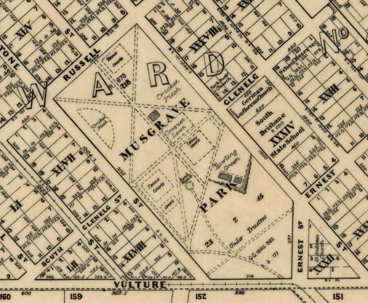
The formal layout of Musgrave Park in 1914 (Qld. State Archives)
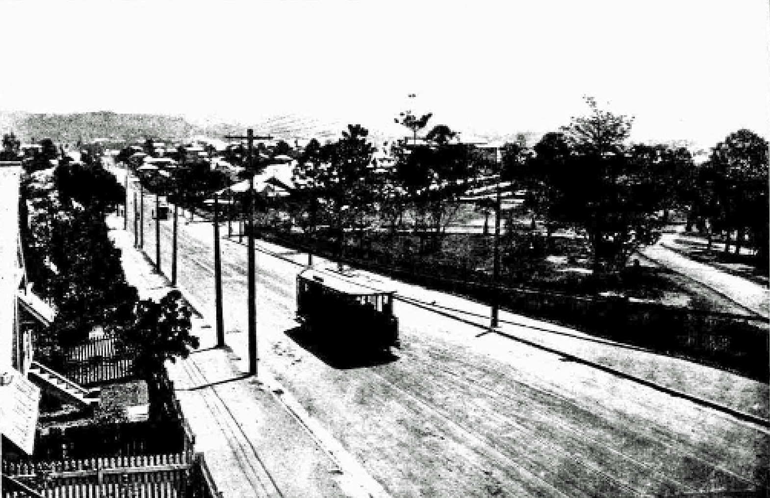
A Dutton Park tram rumbles along Vulture Street past Musgrave Park. Five years later, the portion of the park to the right was used to build the Brisbane State High School. (The Week, 5 Dec 1919 TROVE)
The park layout in 1914 shows sporting activities predominating. The formal layout included radiating pathways at the northern end, lined with trees. Today, only one of the six remains complete with its original trees along with sections of the other former pathways.
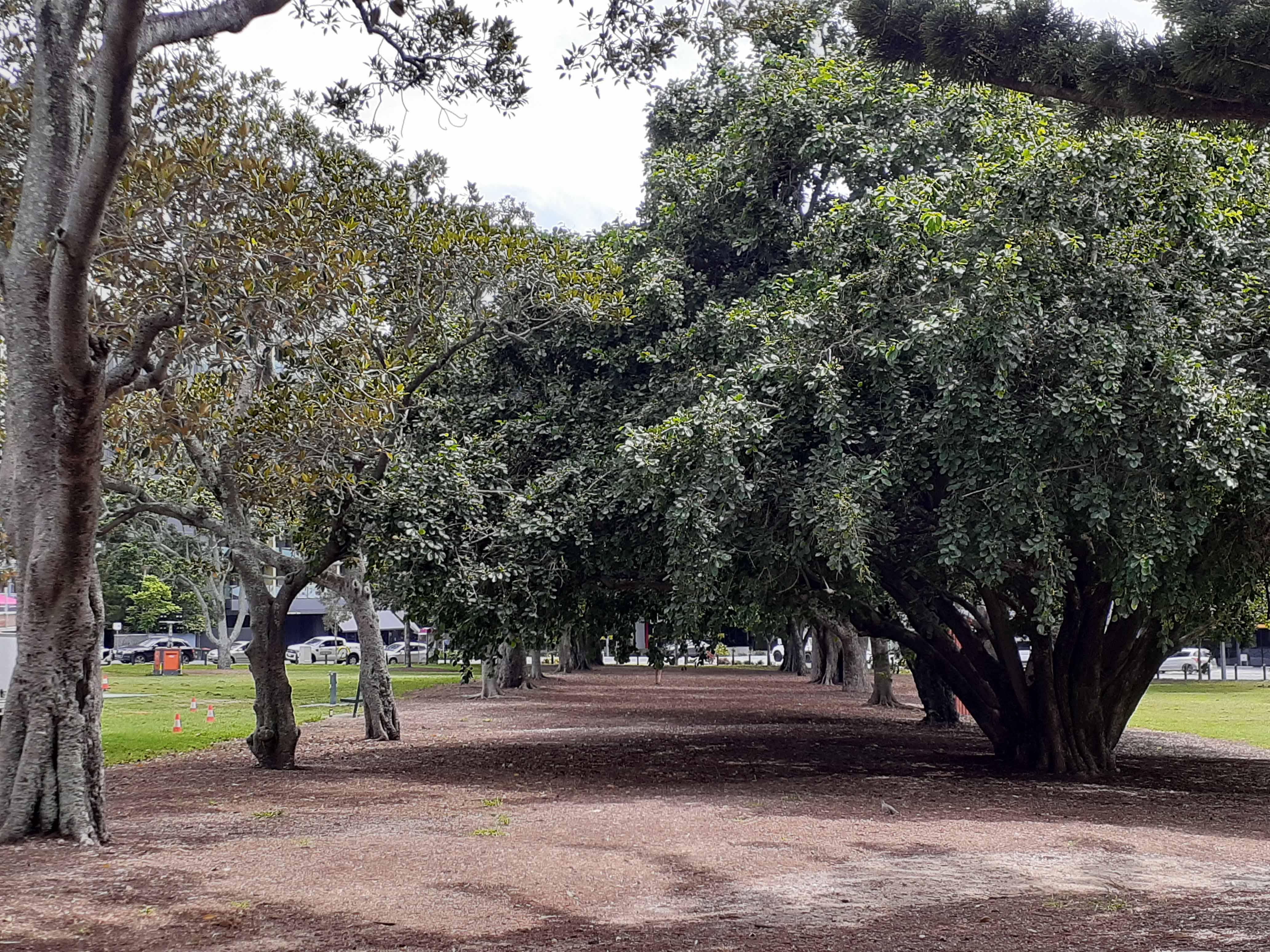
One of the surviving original tree lined radiating avenues. (P. Granville)
The story of Musgrave Park continues in my post More Tales from Musgrave Park .

The red line indicates the boundary of the original South Brisbane Recreation Reserve. The dotted line is the approximate BSHS boundary. (Google Earth)
Legend :
1. St Andrew’s Anglican Church
2. Aboriginal habitual camping site, now Brisbane State High School
3. Bowling Club, now Jagera Hall 4. Swimming Pool
5. Location of 1901 Band Stand 6. Disused Tennis Courts
7. Croquet Club 8. Centre of former radiating avenues
9. Cricket Pitch 10. Approximate location of water hole
© P. Granville 2020
Further Reading
Thanks to the authors of the following for the ideas and information I’ve used in preparing this post.
Indigenous Aboriginal Sites of Southside Brisbane (Dr. Ray Kerkhove)
Paper on indigenous history by Dr. Ros Kidd prepared for the Princess Alexandra Hospital

Thank you for this wonderful writing and research. I live in an old house on Dauphin Terrace – we are only the fourth owners of the house which was built around 1890. It was named Bemersyde and mainly lived in and owned by the Macpherson family who still live on Dauphin Tce.
Composed and sent on my mobile device.
>
LikeLike
Hi Thanks for your comment. Dauphin Terrace is certainly a very interesting l street. I’ve written 3 blog posts touching on it already. Paul
LikeLike
Pingback: The Blakeneys of Highgate Hill | Highgate Hill and Its History
Pingback: More Tales from Musgrave Park | Highgate Hill and Its History
Pingback: The Origins of Orleigh Park | Highgate Hill and Its History
Pingback: Tennis | Highgate Hill and Its History
Pingback: A Strawberry Afternoon Tea Highgate Hill 1905 | Highgate Hill and Its History
I’ve lived my whole life a stone’s throw from Musgrave and have almost five decades of memories from the park, pool and school (and growing) – but wasn’t aware of much of its history and diverse use pre-1970s. Thanks for researching and compiling such a detailed post. A fascinating read to say the least.
LikeLiked by 1 person
Pingback: Alfred Hockings and his “Rosaville” Nursery | Highgate Hill and Its History