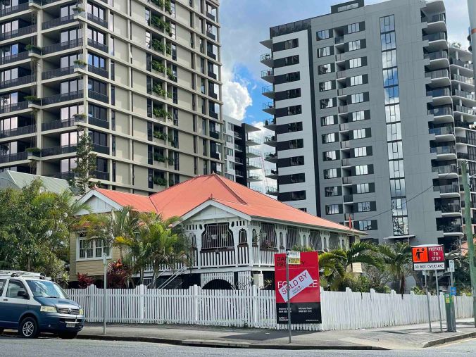
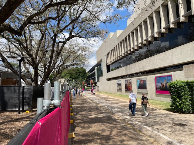
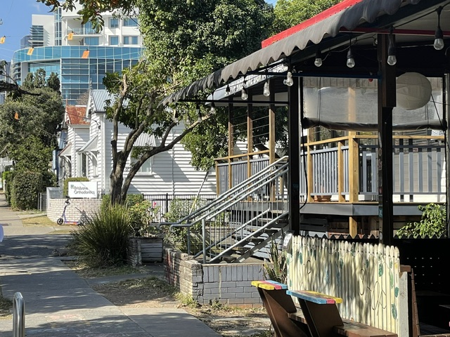
Over the last 30 years or so, the original late 19th and early 20th century homes of South Brisbane have steadily disappeared. One standout survivor is Oriana at 39 Russell Street, on the corner of Manning Street. It has gradually become an incongruous 930 square metre piece of suburbia complete with garden and Hills Hoist, surrounded by high rise development.
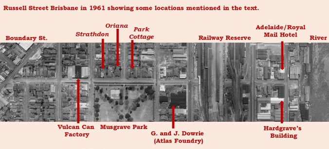
In this post I’ll look at the origins of Russell Street and a little of its history before looking at the last house.
The origins of Russell Street
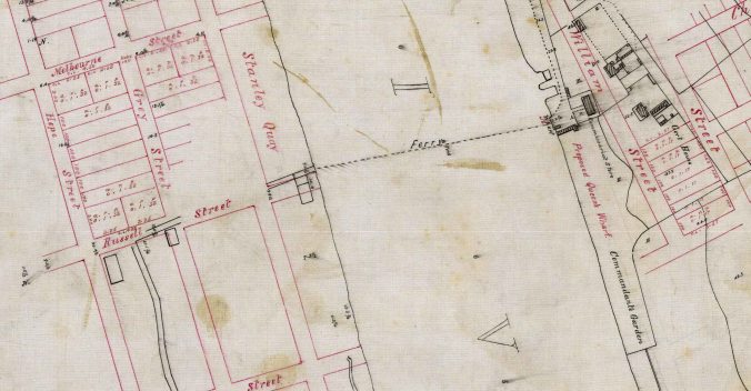
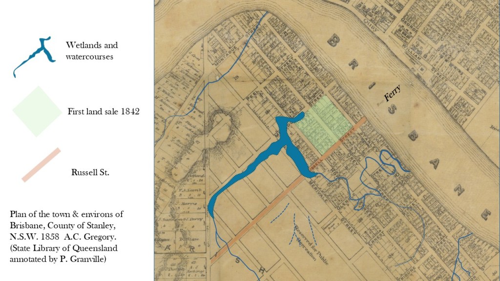
In 1842, surveyor Henry Wade laid out a plan for the streets of North and South Brisbane in preparation for the sales that were to commence with the formal opening of Moreton Bay to free European settlement. The main river crossing was from the Commissariat Store on the north bank to the start of the track to Ipswich. This was the location of the new Russell Street.
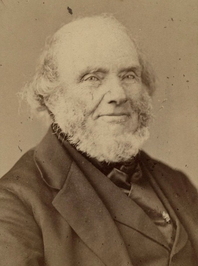
On the south side of the river, the streets were named after prominent politicians who had held the office of Prime Minister or Secretary of State, which was the term used for Minister. Russell Street was named after Lord John Russell, Secretary of State for War and the Colonies from 1839 to 1841, and later Prime Minister.
Thee first Brisbane land sale was held in Sydney in July of 1842. Sixteen lots were sold in South Brisbane fetching between £30 and £150. The land sold is now occupied by the Performing Arts Centre and the South Brisbane Railway Station. A report of the sale was critical of the nature of the land, much of which was “situated in a swamp which is overflowed daily, at highwater”.
A few months later, a war of letters broke out between surveyor Henry Wade and the Land Commissioner Dr. Stephen Simpson, who was also acting as magistrate until the arrival of the settlement’s first Police Magistrate, Captain Wickham. In a letter to the Surveyor General, Wade describes how a Mr. Sinclair arrived from Sydney to inspect the land he had purchased, Lot 1 of Section 1 at South Brisbane. The block was on his arrival almost covered with water partly in consequence of a deep and large excavation marked B having been made by Mr. Williams. John Williams had also constructed a house on Russell Street and soon after built South Brisbane’s first shop and was operating the ferry. Further, Wade complained that a Joseph Liddot had built a house, marked D on the map below, in the middle of the planned Russell Street.
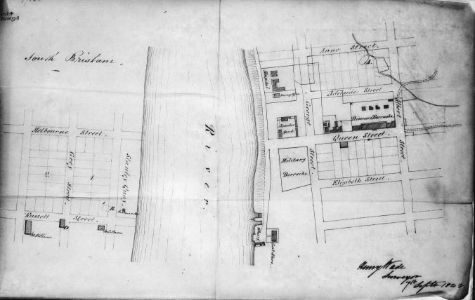
Stephen Simpson responded, writing to the Colonial Secretary. He pointed out that Liddot was a poor man with children, and his slab hut could easily be moved and that he had dined with Sinclair who had told him that he wasn’t concerned about William’s hole. Interestingly though, Sinclair is not shown on maps as a buyer of land in this sale. Simpson went on to criticise Wade’s behaviour in the small settlement, commenting that his want of all the common courtesies usual among Gentlemen has placed him in a position of almost total seclusion from Society.
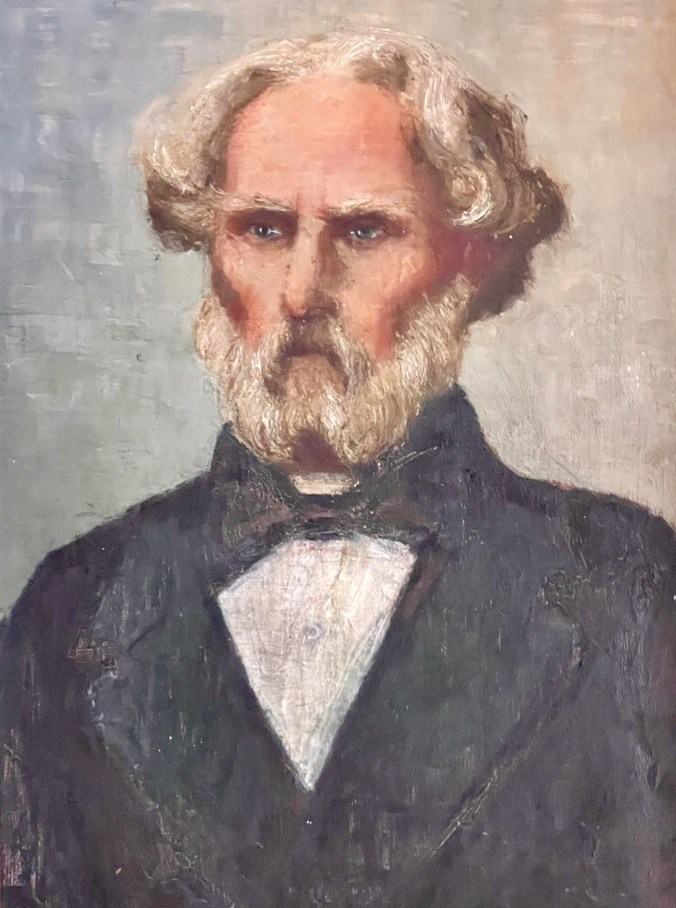
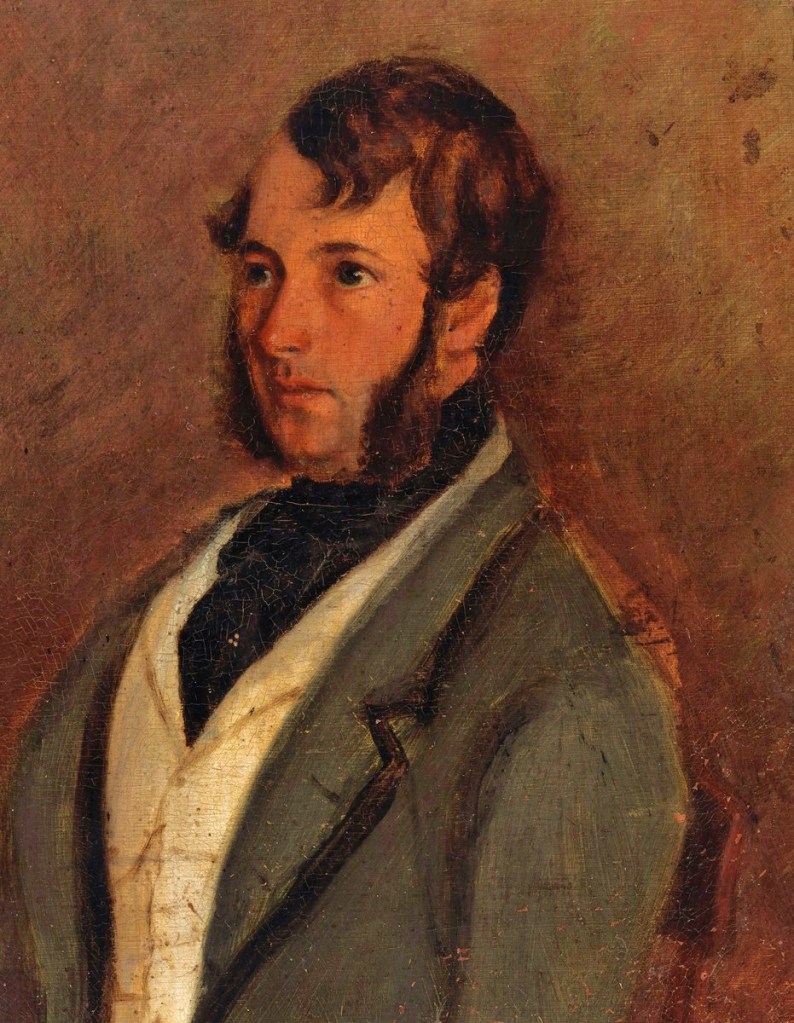
Government Resident Captain Wickham arrived in Brisbane in January 1843. In December of 1844, he wrote to the Colonial Secretary regarding the location of a wharf at South Brisbane. At this point in time, the area along the river had been reserved as “Stanley Quay”. Later, Stanley Street was established, with the land along the river bank sold as freehold.
I have the honor to inform you that owing to the quantity of water that remains, for a considerable time after rain, on nearly all that part of the township near the bank of the River, the only convenient landing place for stores is at the end of Russell Street, or on that part of Stanley Quay adjoining.
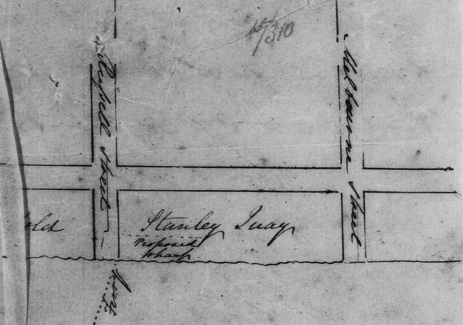
This land was later purchased by the Hockings brothers who operated a saw mill in the location. See my post Albert Hockings and his Rosaville Nursery for more.
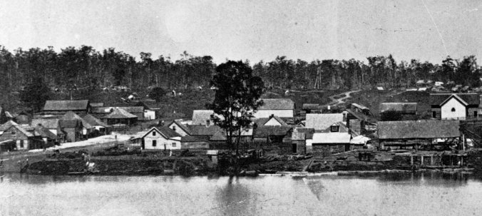
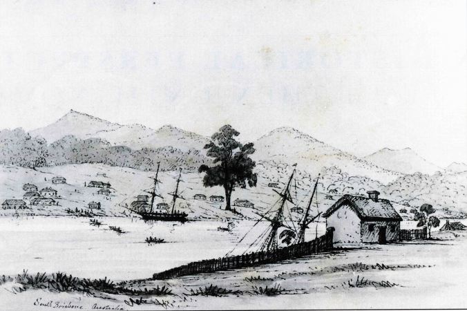
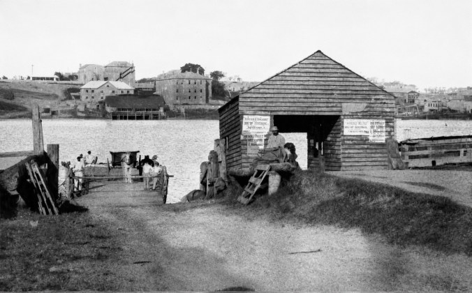
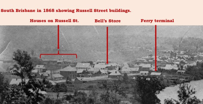
The end of Russell Street was also used as the ferry terminal from its inception in 1842. It was run in the early days by the John Williams mentioned above who constructed a punt to transport horses and vehicles. It was so slow in operation that it was nicknamed the Timewaster . Russell Street was the best route to take to reach the West End area farms. Melbourne Street, later the main thoroughfare, was subject to frequent flooding and was often boggy.
A brief history of the street
Until the 1880s, development along Russell Street was largely confined to a few blocks back from the river. Growth on the southside was very slow largely because there was no bridge. One notable establishment on the corner of Russell and Stanley Streets was Bell’s ironmongery, drapery and grocery store.
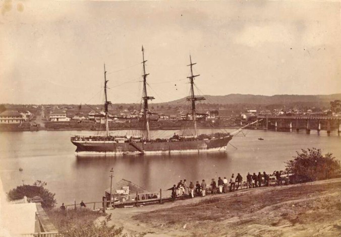
After years of attempts by the Brisbane Council to obtain funding for a bridge, a political compromise saw the Colonial Government transfer large amounts of unsold land in South Brisbane and Dutton Park to the Council. This was mortgaged to fund construction. Due to the complex situation I described in my post The Fascinating Story of the First First Victoria Bridge , this meant the so called Bridge Lands were not available for sale until the early 1880s.
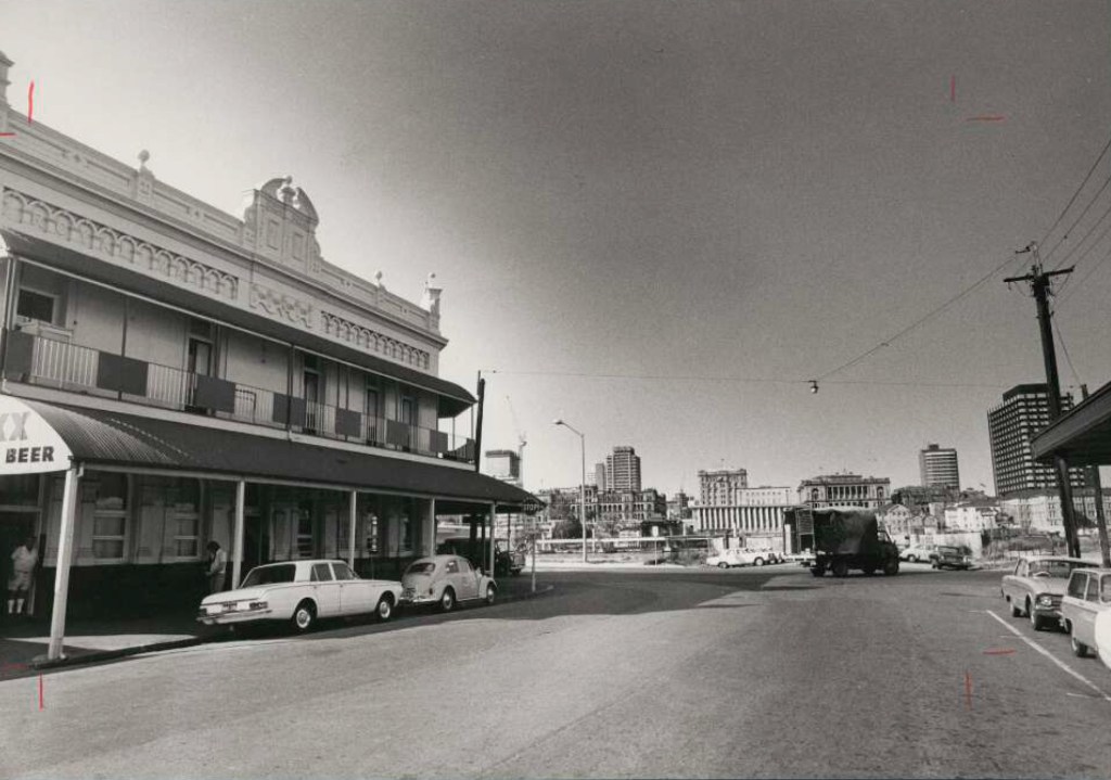
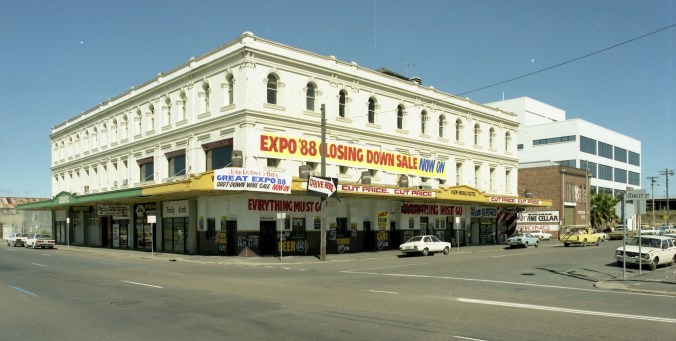
South Brisbane finally began to grow, with Stanley Street developing into a major commercial center with some impressive buildings. On the northern corner with Russell Street, the Royal Mail Hotel opened in 1888, replacing an earlier simpler hotel. On the southern corner, John Hardgrave built a general use commercial building. Amongst its early occupants were the Queensland National Bank and the Russell Family Hotel.
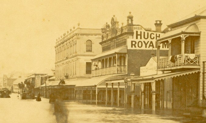
Both buildings survived until the Expo88 development saw them demolished. By this time the Royal Mail Hotel was known as the Adelaide, and Hardgrave’s Building was home to the View World Hotel.
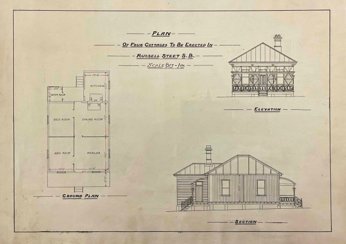
Land sales also led to the development of housing along Russell Street. The plan for one of 4 identical cottages built ca. 1891 at numbers 59-65 survives at the State Library of Queensland. Curiously each house occupies just 13.5 perches, when the 1885 Undue Subdivision of Land Act specifies 16 perches (404 square metres) as the legal minimum. This was due to the 4 cottages being on just two titles each owned by an investor.
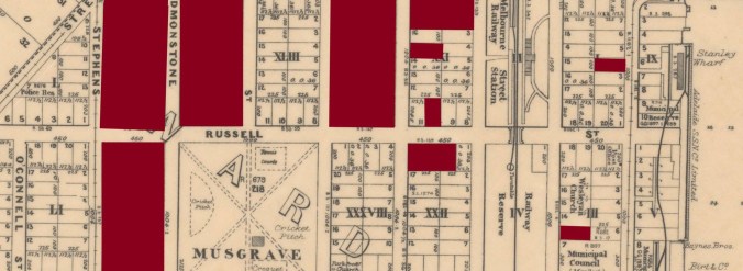
In 1891, land on both sides of Russell Street between Grey and Hope Streets was resumed to make way for the new South Brisbane Railway Station. Today this area has been subsumed into the Convention Centre.
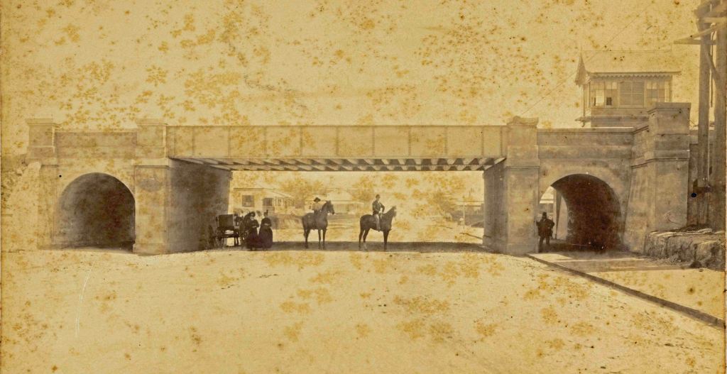
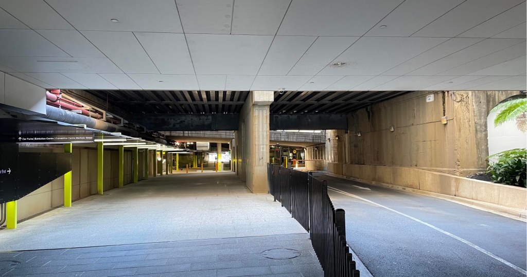
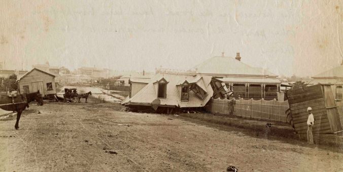
The 1893 flood wreaked damage across South Brisbane, including Russell Street.
Early in the 20th century, industrial buildings began to appear along the street. The furniture manufacturer and retailer Tritton’s built a large factory ca. 1908 at the location today of the QPAC Glass Theatre. After construction of a new factory on Vulture Street adjacent to the West End State School in 1937, the building was used as a warehouse.
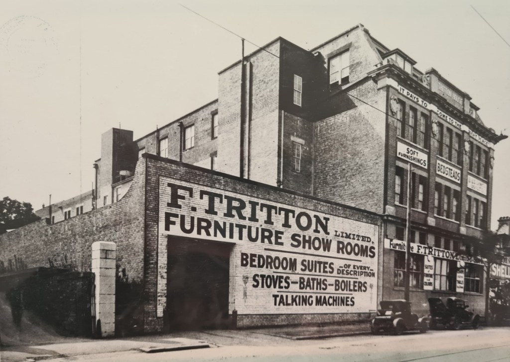
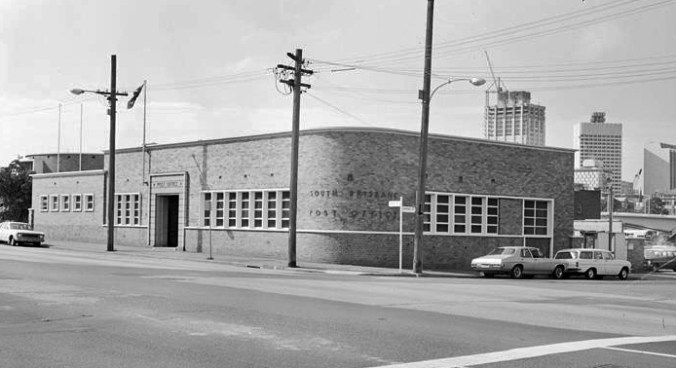
In around 1950, it was demolished and a new post office was built on the corner. It was in turn demolished as part of the Expo88 development.
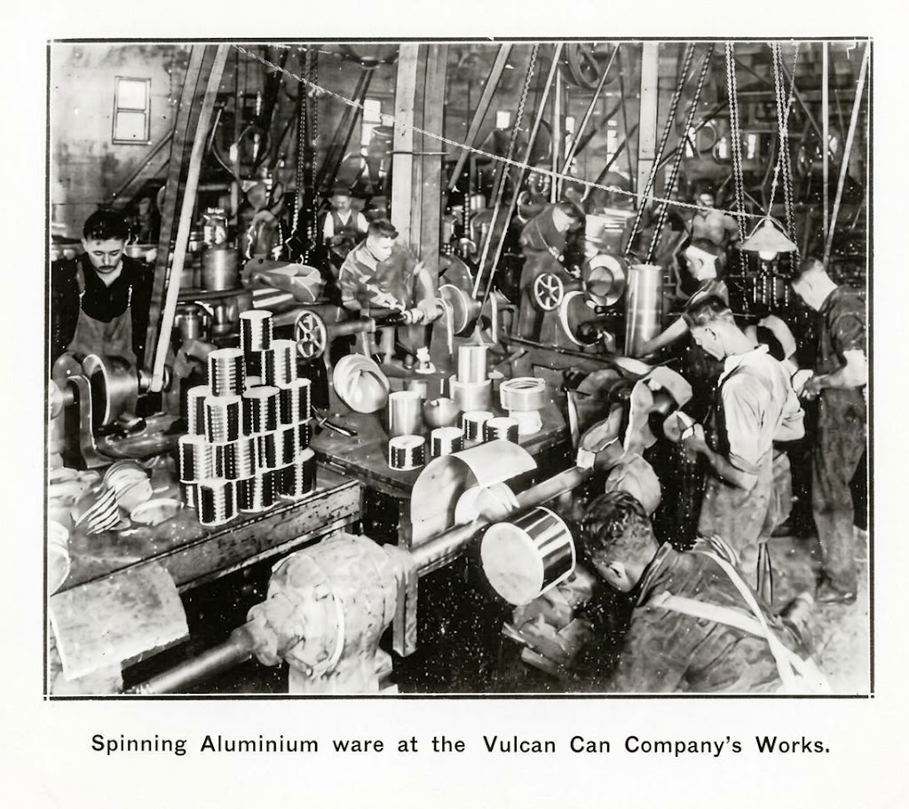
Along Russell Street between Hope and Manning streets, there were at various times engineering works, and metal ceiling, shirt and a can factory.
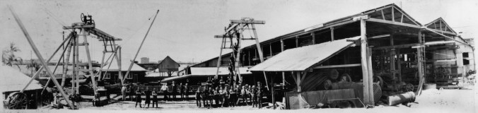
From the 1980s, houses and factory buildings were progressively demolished to make way for new residential and commercial development. While I’ve given this post the name of “the last house standing”, there are number remaining at the end of the street at West End.
Number 39 – “Oriana”
The land
With large numbers of immigrant ships arriving in Brisbane in the 1860s, there was a surge in sailors trying to remain here by various means. In 1862, Henry Beach was one of a group of sailors who attempted to desert from the emigrant ship Theresa using one of the ship’s boats. The captain stopped them, threatening to shoot with his musket, which it transpired was not loaded. They then went on strike, which under the maritime law of the time, was punishable by 3 months imprisonment with hard labour. Refusing to obey orders was a common tactic used by sailors who didn’t want to continue with the ship, which usually departed before the 3 months were up.

A reporter at the Water Magistrate’s Court commented that, after sentencing, the weight of the sentence did not appear to affect the sailors so much as it did certain young ladies of a somewhat new-chummish appearance, who were congregated about the precincts of the court, and sobbing and crying in a most remarkable manner.
After serving his 3 months, Henry worked as a sailor. A year after his release, he married Catherine Behen, a young Irishwoman from County Clare who had been a passenger on the Theresa. She was possibly one of the upset women mentioned in the newspaper article quoted above. In 1874, they purchased a 36 perch (910 square metre) block of land on the corner of Russell and Manning Streets for £62, and built a new home they named Park Cottage.
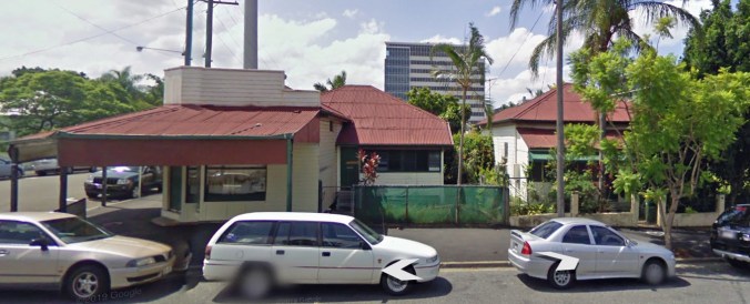
In 1880, at one of the first sales of Bridge Lands, Henry paid £205 for the companion block to the one he’d purchased in 1874 on the other side of Manning Street, where Oriana was eventually built. In six years, the price of land along Russell Street had more than tripled, probably due to pent up demand after the construction of the bridge. Henry died in 1883, by which time he was working as a storekeeper at the Port Office. The family continued living in Russell Street until at least the 1920s. The block Henry had purchased across Manning Street remained empty, and eventually was purchased by George Sherry.
The Sherry family
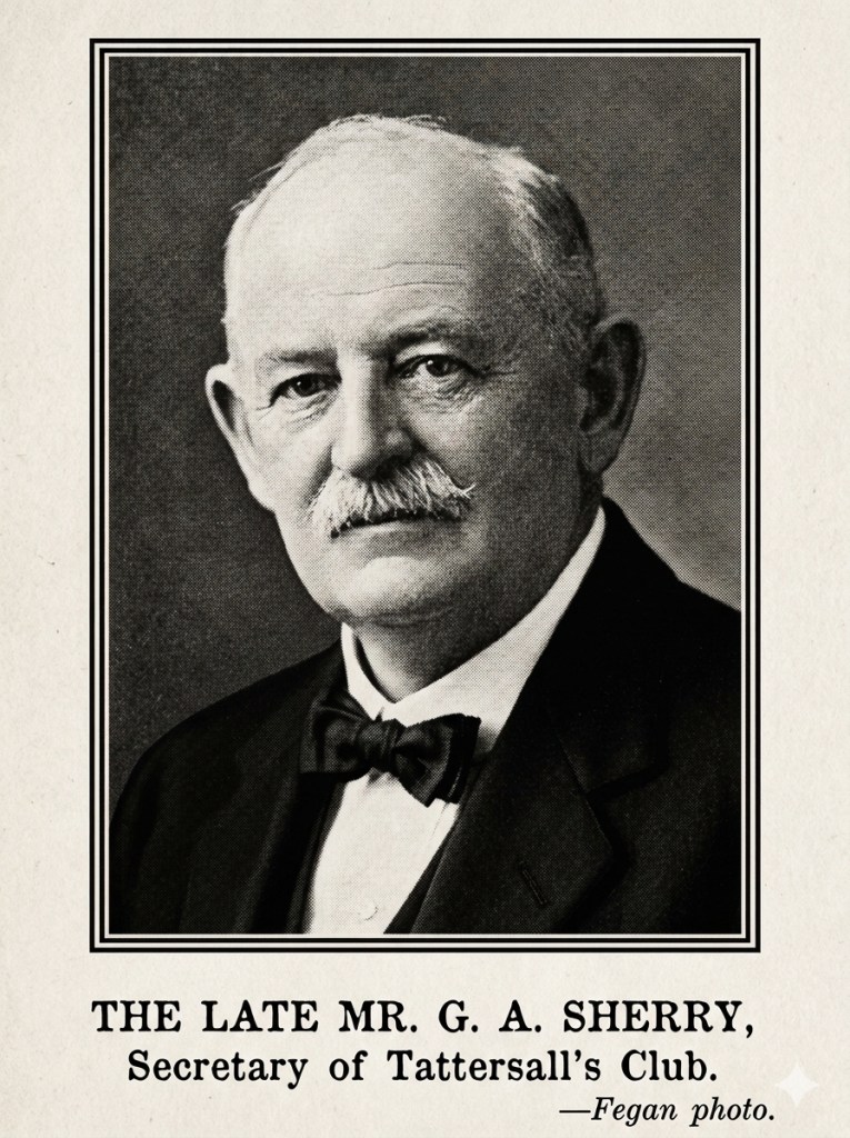
George Sherry was born in Warwick, Queensland in 1862. He worked as a postmaster, hotel keeper and as an insurance representative for AMP. While with the NSW Post and Telegraphs in Braidwood New South Wales he met Sarah Jane Heazlett and they married in 1884. Sherry had also owned race horses, and for some years was the treasurer of Tattersalls Club in Brisbane. By 1903, the Sherry family was living in Strathdon at 45 Russell Street. They had five children, including Gladys who was born in 1892. In 1917, Gladys married dentist Thomas “Ray” Neill at the nearby Park Presbyterian church, which at the time of writing was occupied the Dedicated Fitness Gym.
The Neill family
Ray Neill was born in Rockhampton in 1887. After spending time as an apprentice jeweller, he found his calling as a chemist and completed his apprenticeship. Ray practised for many years in Rothwell’s Chambers, a building still standing in Edward Street. By 1920, Gladys and Ray were living in their new house Oriana, built on land belonging to Gladys’ father George but left to them in his will. They had three sons and a daughter, although their firstborn son died in infancy.
The three children all went to the nearby South Brisbane State School and Brisbane State High School. This was the time of public examinations for grade 8 (Scholarship), 10 (Junior) and 12 (Senior) with results published in newspapers. In 1939, Donald won the Byrnes Memorial Medal for the best junior pass in the state, and a newspaper photographer captured him watering the lawn at Oriana.
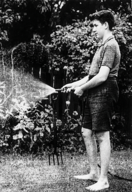
The Neil’s oldest surviving son Warren also became a dentist and moved away. The other children, Donald and Irma, lived in the house for most of their lives. Irma worked as a typist. Donald, who had become a doctor, featured in the news once again in 1965. The Queensland Rugby Union needed a new home. Mayor Clem Jones decided to enclose Musgrave Park for their use, and sent in the bulldozers. By this time, the original trustees of the park had all died and weren’t replaced, leaving the City Council as the sole trustee.
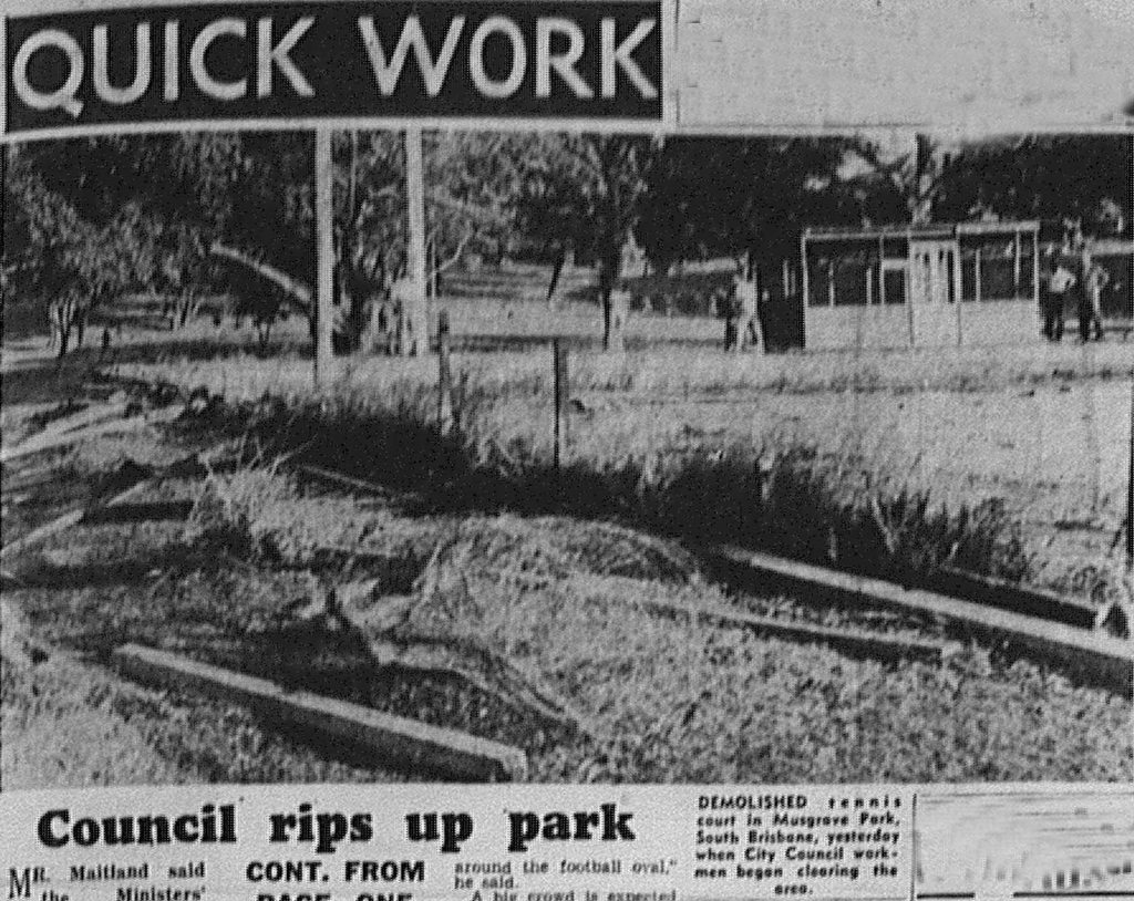
Dr Neill was president of the Musgrave Park Protection Committee and sought a High Court injunction to stop the work. Although the court found that Dr Neill was not entitled to bring the action, mounting public opposition led to the Bjelke-Peterson government making Ballymore available. By this time, a children’s playground, several tennis courts, and a row of mature trees had disappeared. As a result, looking towards the park from Russell Street today, on the right there is a flattened open area, and on the left there is still a double row of 140 year old trees where the bulldozers didn’t reach. For more on this see my post More Tales from Musgrave Park.
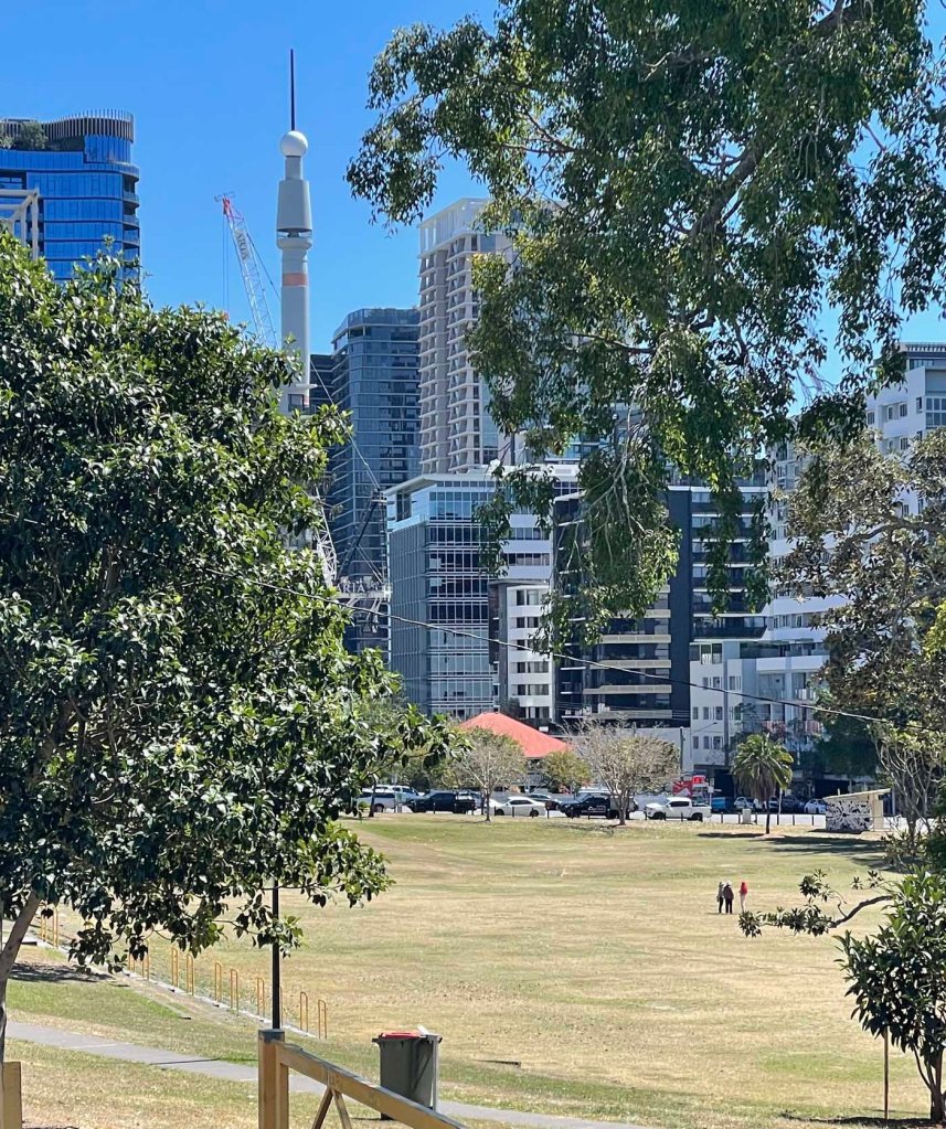
The Neill family retained ownership of “Oriana” until Irma died in 2008, when it was sold to private owners for $1.8 million. The new owners kept the garden in good order, and the property retained its homely suburban appearance.
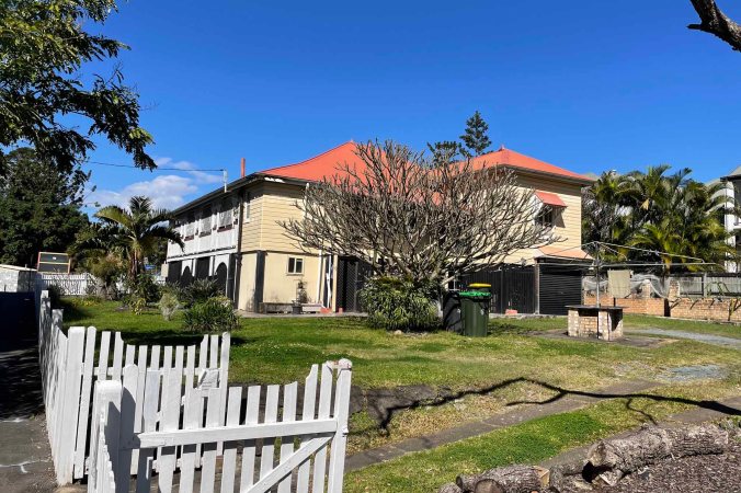
In 2026, the owners of Oriana were made an unsolicited offer that they couldn’t refuse. The 930 square metre block, was sold for 14 million dollars. The price reflects the ability to build a building of up to 30 floors under the Kurilpa Temporary Local Planning Instrument.
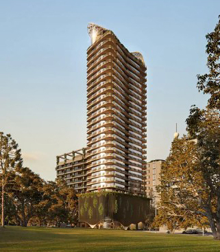
Russell Street, South Brisbane will lose the last vestige of suburbia.
© P. Granville 2026

