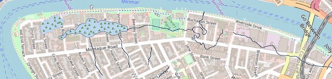
When TimeOut listed Montague Road, South Brisbane, as the world’s 6th coolest street for 2025, quite a few eyebrows were raised. It did get me thinking that I should put together all the stories relating to Montague Road that I’ve researched into one document. Where I’ve published a detailed blog post, you can access it by using the “more on this topic” button.
The birth of Montague Road
At the time of the arrival of Europeans in 1824, the land along the path of Montague Road was largely rainforest and wetlands. It was a good hunting ground for its Turrbal and Yuggera owners and very likely cultivated in part as semi-gardens. Large parts of the land between Montague Road and the river were low lying and flood prone, with Kurilpa Swamp being a major feature.
After the closure of the convict settlement and opening of Brisbane to free European settlement by the NSW Governor, land was surveyed in preparation for land sales, that began in July 1842. In South Brisbane, an area within a small grid of streets along the river was divided into town blocks, whilst “suburban blocks,” increasing in size from around 1 acre to 9 acres down Montague Road were sold for farming and grazing use.
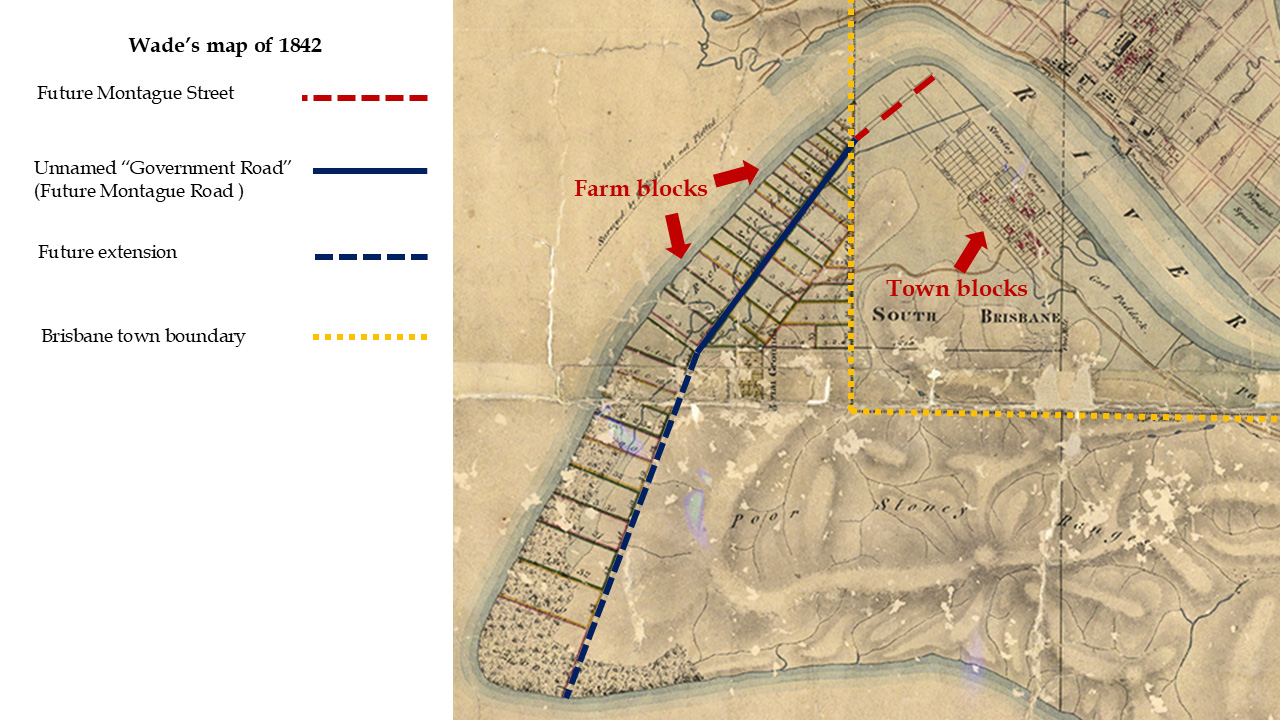
Further streets were added to the town grid, and Montague Street first appears in an 1851 land sale. Similarly to the naming of streets across the river after members of the royal family, those on the southside were named after prominent aristocratic politicians who served in roles such as Prime Minister and Secretary for the Colonies, for example Earl Grey and Lord Melbourne. However, there was no well-known politician named Montague.
My belief is that the intention was to name the street after Lord Monteagle, who in 1850 moved an amendment in the House of Lords for Australian colonies to have an upper house, with members nominated by the Governor, as well as an elected Legislative Assembly. A report in a Sydney newspaper incorrectly gave his name as Montague.

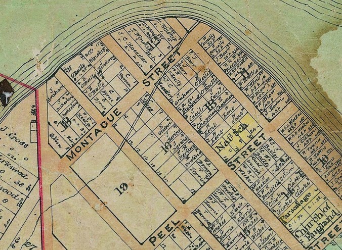
The extension of Montague Street beyond Merivale Street followed a road reserve between blocks of farmland. Both maps and Post Office Directories from 1878 show it as Montague Road.
A brief history of Montague Road
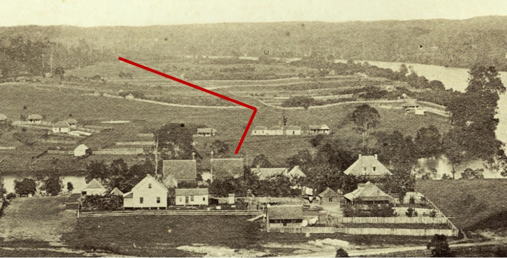
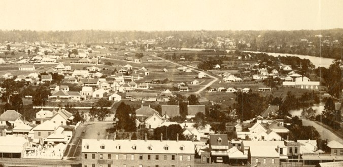
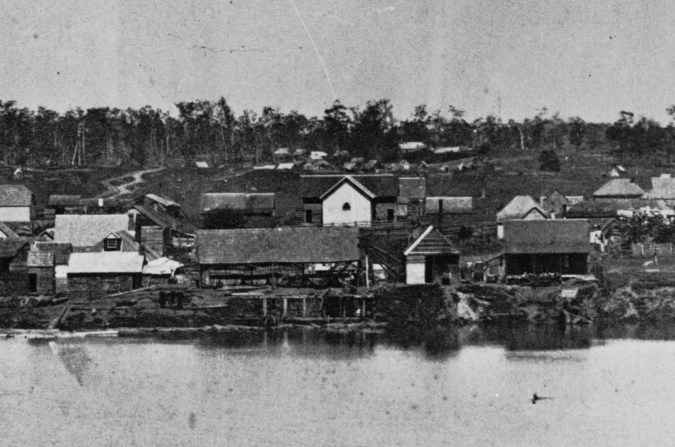
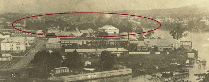
The lack of a bridge across the river before 1874 impeded growth in South Brisbane. The 1862 image below shows no buildings on Montague Street, and a row of farms between Montague Road and the river. The land remained principally agricultural until after the completion of the first Victoria Bridge in 1874.
By the mid 1880s, there were scattered houses along the northern end of the road as well as a small amount of industry such as Carmichael Brothers’ sawmill. Further along Montague Road, farms still predominated.
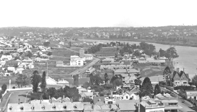
By the 1890s, industry was replacing agriculture. This trend continued, extending south along the river. Farther down Montague Road, numerous houses had been built on subdivided blocks.
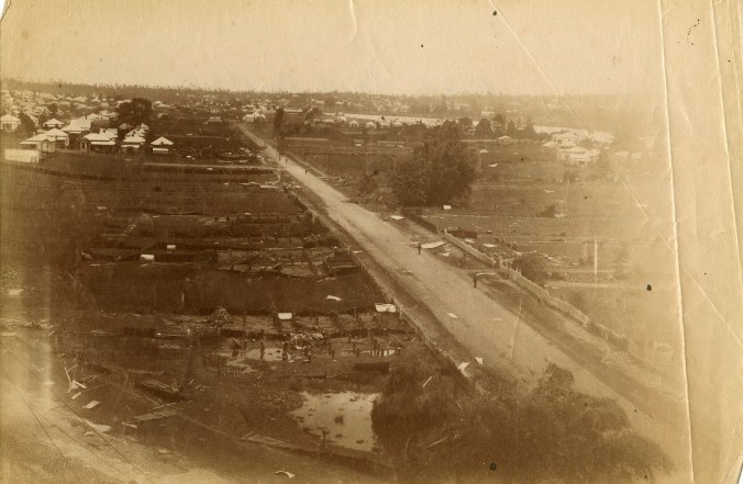
The area was hit badly by three devastating floods in early 1893. Many houses and businesses were destroyed or badly damaged.
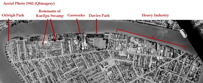
Through the 20th century, the industrial use of the land along Montague expanded southwards, with significant businesses such as Austin Glass, Stewart and Lloyds steel fabrication, Humes Pipes, and Montleith Brothers steel pipes establishing large factories. By mid-century, heavy industry extended down the river side of the road almost as far as Jane Street. The east side of the road remained predominantly residential.
Similarly to other busy roads around Brisbane, the surface was progressively upgraded over a long period of time. During the 1890s, it was laid with “white metal” or quartzite. By the 1920s, traffic had increased to the point that work was underway to asphalt the road surface, although it progressed at a very slow pace, drawing some criticism.
Recent decades have seen a gradual change in land use from heavy industry to commercial and high rise residential.
A walk down Montague Road
Let’s go for a walk down Montague Road, looking at what has survived and some of the interesting events and characters of the past.
Swimming baths
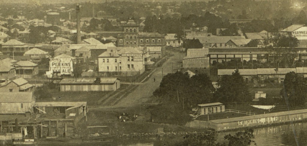
The popularity of swimming as a pastime and sport rose quickly from the 1890s. The floating Victoria Bath, built in 1890, was initially anchored at New Farm but moved to the northern end of Montague Road in 1891. It was destroyed by the flood of 1893.
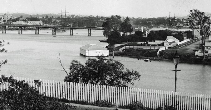
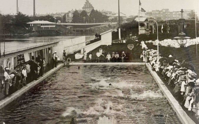
In 1902, the South Brisbane City Council constructed above ground baths near the same location, at the end of Montague Road. Water was pumped in from the river daily. It was a very popular venue but closed in 1927 after the opening of the larger Davies Park Baths.
The Montague/Coronation Hotel
The Montague Hotel was constructed in 1891, with the first publicans being George and Sarah Lotz. Various newspaper reports of the three floods that hit Brisbane in February of 1893 commented that the water level almost reached the ceiling of the top floor in the first flood. During the third flood, the remains of the verandahs were swept away.
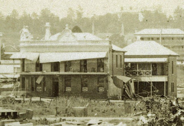
The hotel was back in operation later in 1893. One morning in September a visitor named George Sheppard ordered a beer and then hung around the pub the rest of the day. That night, Sarah found him in her room rummaging through her drawers. Sheppard calmly went down to the bar and ordered another drink. An altercation with George broke out, with his use of a mallet proving more effective than Sheppard’s chosen weapon, a chair. The police carted Sheppard off to hospital where he could recover before appearing in court.
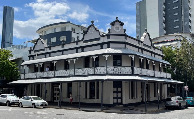
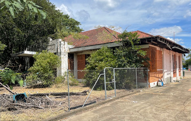
In 1911, the pub’s name was changed to the Coronation, no doubt in honour of King George V and Queen Mary. After operating as a hotel for almost 100 years, it was purchased by QUF industries, now Pauls Ltd., for redevelopment, which did not eventuate. Since then, it has been used for a variety of purposes such as a a backpackers hostel, and most recently as a vintage bar. At the time of writing it had been purchased for transformation into office space.
The West End Brewery
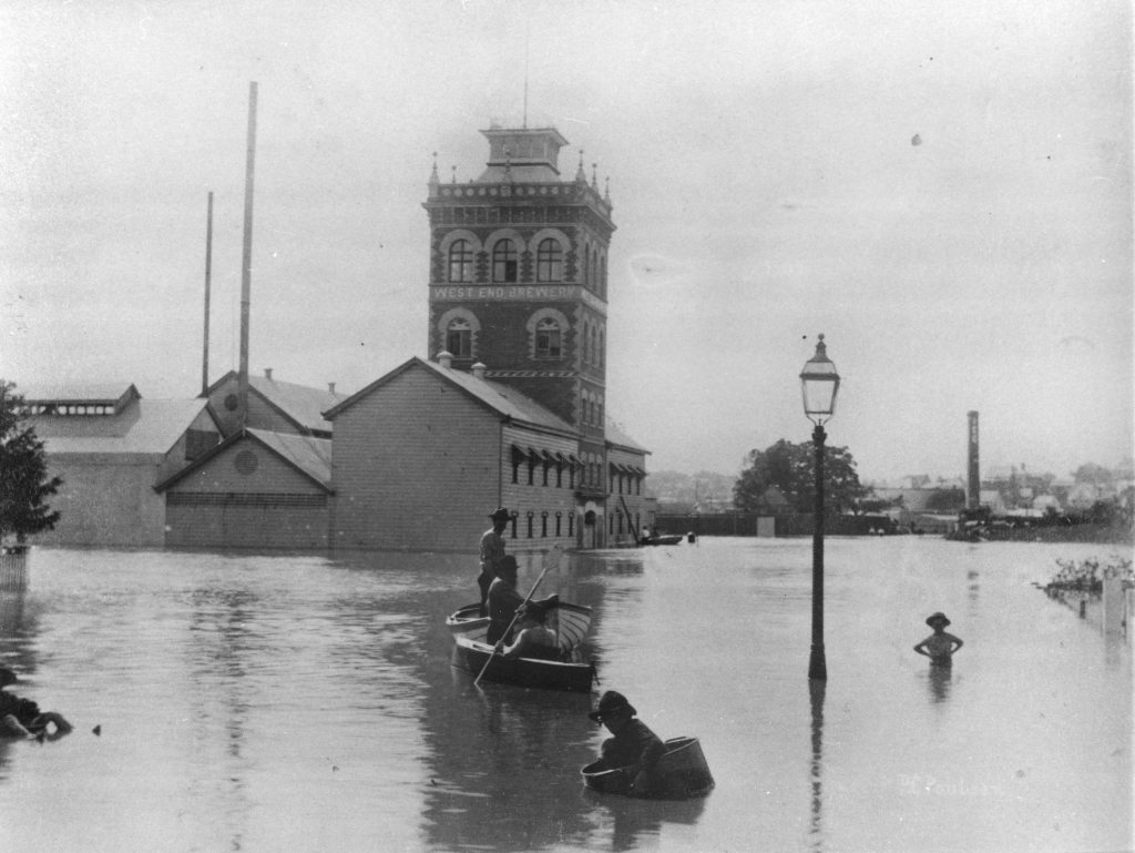
In 1886, local businessman George Bruce-Nichol, in partnership with a brewer called Charles Lanfear, remembered today by a street in the vicinity, established the West End Brewery. At the time of the 1893 floods, work had commenced on an imposing new brewery building. A central tower had been completed, and not much more survived the flood. Some 500 barrels of beer disappeared downstream. Many were washed up on the riverbank at locations such a New Farm, much to the delight of local residents.
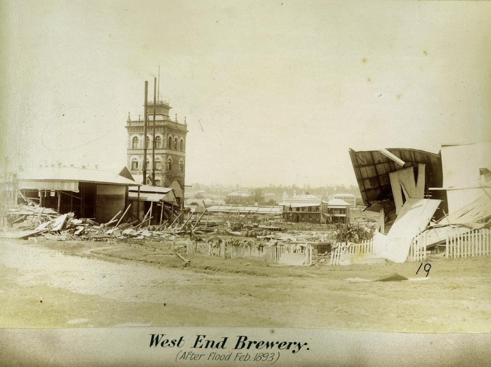
The brewery tower survived, and new buildings were erected in a matching style. During 1895, the quality of the beer dropped drastically for some months and sales plummeted. Some months later the brewer Lanfear, who was held responsible, was sacked. He later unsuccessfully tried to sue the company for libel and unfair dismissal. The business recovered, and in 1908, the company purchased an adjacent acre of land to establish a new brewery to produce lager. Possibly due to strong competition, the West End Brewery ceased trading in 1914.
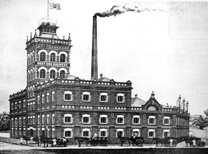
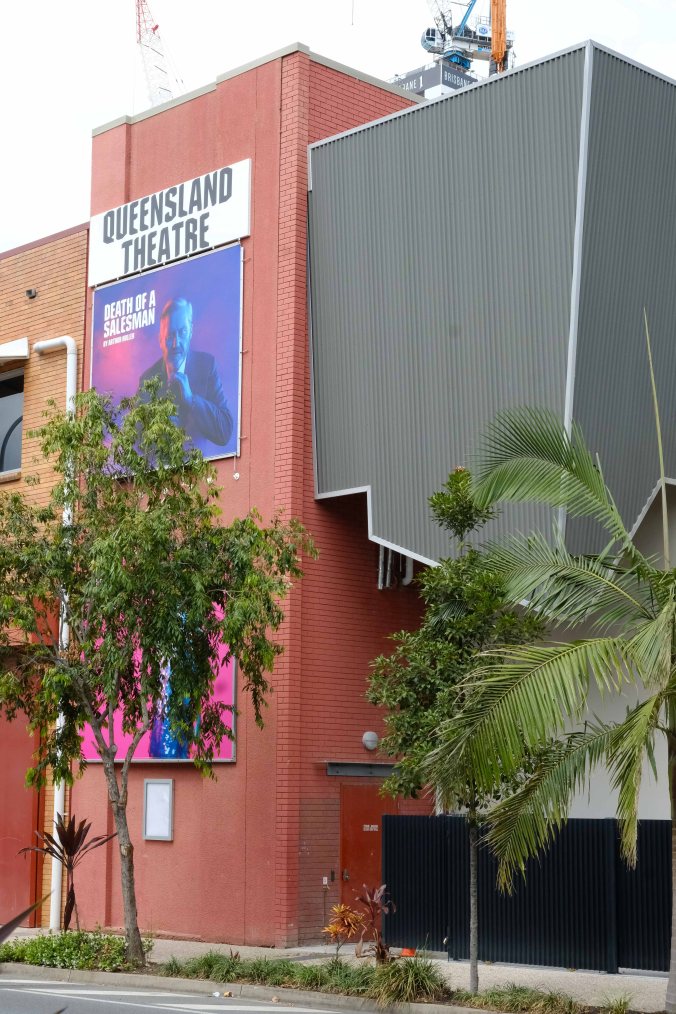
In the 1920s, Evans Deakin Pty. Ltd. established a workshop on the other side of Montague Road. The company purchased the old Brewery buildings in around 1945, to allow for expansion. By the early 1960s, only the northern section remained, with an original brewery wall being incorporated into a new Evans Deakin workshop building. The remainder was demolished later in the 1960s.
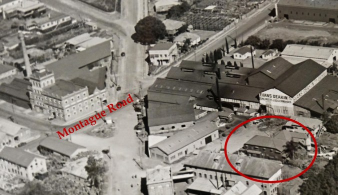
Some of the Evans Deakin buildings remain, now used by the Queensland Theater Company. A small section of remaining brewery brickwork is visible from Cordelia Street.
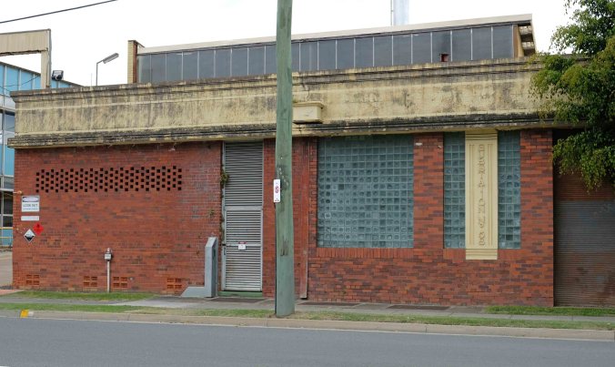
Stewart and Lloyds Factory
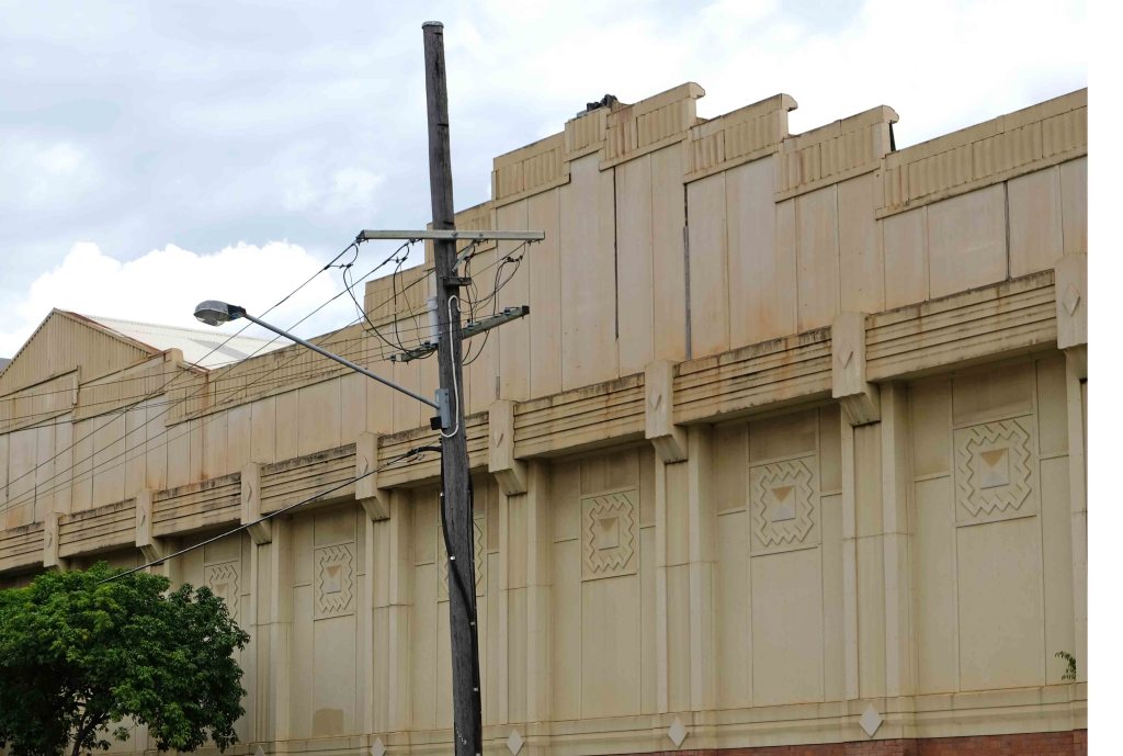
At number 99 stands an example of the heavy industry established along Montague in the mid 20th century. This is the factory and and office buildings constructed in 1937 for the British company Stewart and Lloyds, wrought iron and steel manufacturers. The art-deco facade features plaster relief decoration of diamonds as well as horizontal and vertical fluting.
Nearby is electricity substation 58, completed in 1940 for the Australian Glass Manufacturers’ factory, although operated by the City Electric Light Company, now Energex. An unusual feature is the use of glass tile bricks, produced by the company. The glass works commenced operation here in 1918.
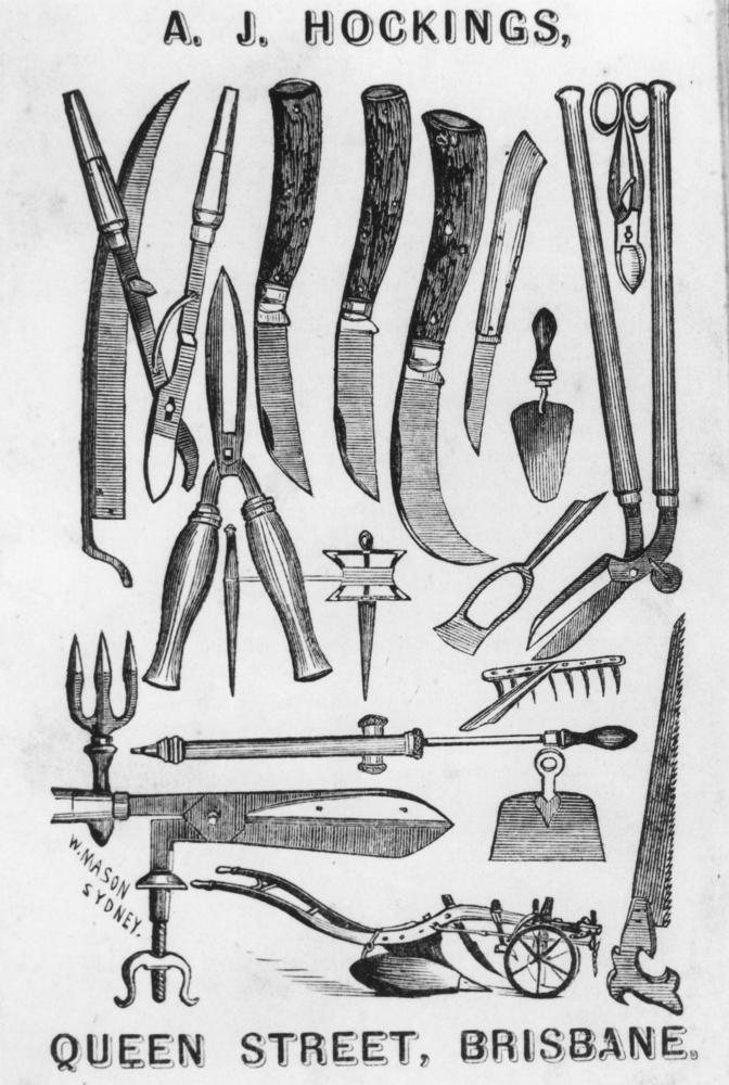
Hocking’s Rosemount Nursery
In 1848, two brothers Albert and Henry, recently arrived from Sydney, opened a store in Grey Street, South Brisbane. By 1852, Henry had returned to Sydney, and Albert ran a general business and sawmill from what was known by then as “Hockings Wharf”.
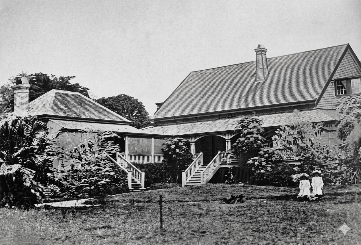
Albert married Elizabeth Bailey in 1851, and the couple made their home at “Rosaville”, located on some 7 acres of riverside land, later expanded to 10 acres ( 4 hectares). Here, they raised their family of 9 children, with another dying in infancy.The property today is bordered by Hockings and Donkin Streets and Montague Road.
They later built a home called “The Oaks” adjacent to the old house.
Albert established a nursery on this land in the early 1850s. He experimented with a wide variety of fruit trees and developed hybrids suitable for the Queensland climate.The visitor entered from Montague Road into a large greenhouse covered with creepers that housed about 4,000 plants in pots. Beyond there were “propagating frames” with some 2,000 more plants. The rest of the nursery contained around 40,000 fruit trees and vines. In 1886, the nursery covered 7 acres (about 3 hectares) with a further 2 acres leased for experiments in corn and potato varieties.
Hockings distilled his years of experience into two books. The “Queensland Gardening Manual” was originally published in 1865, with further editions in 1875 and 1888.
Alberte died in 1890, aged 64. In addition to his business activities, he had served as alderman and was mayor of Brisbane in 1865 and 1867.

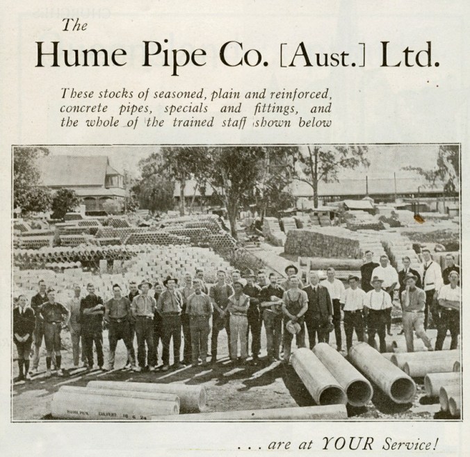
The family sold off the land in stages. One purchaser was Hume Pipe Co. Ltd. and their concrete pipe manufacturing facility opened in 1921. Another part of the property was used by the Australian Chemical Company to produce products such as paint and carbolic acid (phenol). By 1922, local residents were complaining of noxious fumes.
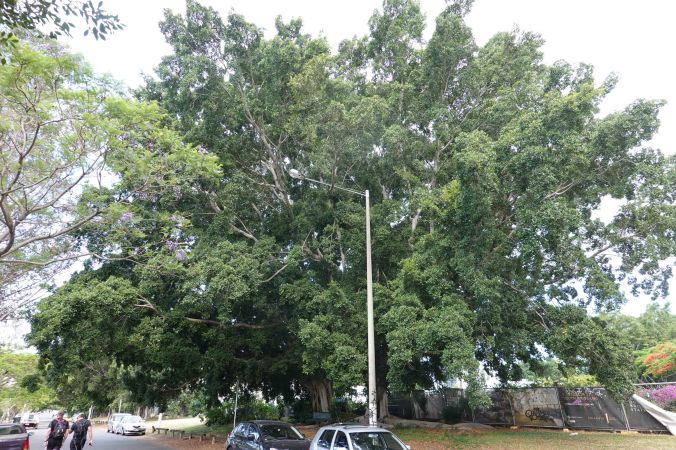
Given their size, it’s possible that some of the riverside trees were planted by Albert Hockings.
Battling brothels
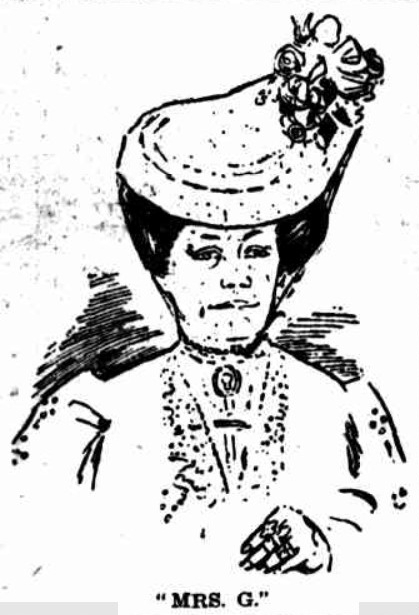
Irish born Margaret Gregson became something of a household name in Brisbane in the early twentieth century through her highly successful “bawdy house” on Montague Road, and frequent newspaper reports of her activities and appearances in court. Her movements were recognisable by the faithful Irish terrier that trotted along behind the cab driven by her long term friend ‘Jo Jo’ Wilson. The Truth newspaper referred to her as “The Duchess of Montague Road” and her employees as “Mother G”.
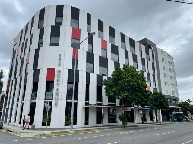
Her base was a large house known as “Botany Villa ” at what is now 225 Montague Road. Her campus extended down to the river and included at least 3 other buildings.

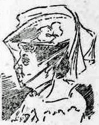
In the early 20th century, there was great rivalry between the Duchess and Alice Osborne, whose establishment, Killarney, was near the southern end of the Go Between Bridge. Poaching employees from each other often led to problems.
In 1908, for example, Nellie Sinclair was arrested at Botany Villa. One of Mother G’s employees, Nellie had gone to Killarney at 11pm one night livid with anger, as she had heard that her former employer Osborne had written “letters of a damaging nature” regarding her suitability to retain custody of her child. The court report mentions that she had broken 33 panes of glass and damaged curtains and blinds. Nellie was ordered to pay £4 fine and another £4 to repair the damage.
Margaret seems to have retired in around 1914, and in 1926 she passed away aged 72, leaving assets worth over £25,000. Amongst other beneficiaries of her will, she left generous sums to pay for the education of 11 grandchildren.
Long after Margaret and Alice had passed on, their establishments were once again very active during World War 2.
At this point, we’ve arrived at a bend in Montague Road, reflecting the larger farming blocks along the river surveyed from here on back in 1842. It’s time for a break, and in a future post, I’ll complete this walk down Montague Road.
© P. Granville 2026

Paul, another supreme piece of work.
I shall read this again, several times, then take a slow walk down Montague Road.
Well done.
Bill
Dr William J Metcalf
Adjunct Lecturer, Griffith University,
Honorary Associate Professor, University of Queensland,
Brisbane, Australia
LikeLiked by 2 people
Thanks very much Bill. I divided the post into 2 parts as it was so long so there’s more to come .
LikeLiked by 1 person
Have lived in the West End area since 1988 and now live just off Montague Road, never knowing the story of the settlement of the precinct. Thank you for so skillfully researching and sharing this information. On my daily walks along the road I will be recalling how it use to look and the past events it has witnessed.
Look forward to Part 2
Hazel
LikeLiked by 1 person
Thanks very much Hazel . I really appreciate hearing from people who enjoy my blog .
LikeLike