The Kurilpa peninsula, encompassing South Brisbane, West End and Highgate Hill, is named for the Fawn-footed Melomy called the “corril” or “kuril” in various South Eastern Queensland languages. Covered by extensive wetlands, Kurilpa was a source of both food and drinking water. After European settlement, the Kurilpa area went through a period in which the wetlands were polluted and expensive drainage works were undertaken while ironically there were frequent shortages of water for household use.
The geography of Kurilpa – “water, water everywhere”
The map below, produced by Henry Wade in 1844, shows clearly the ridges along the paths of today’s Dornoch Terrace, Gladstone Road, and Hardgrave Road.
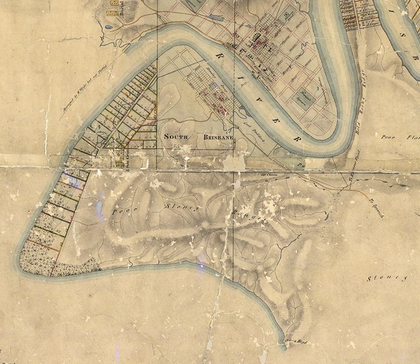
From these ridges, creeks flowed in various directions, including to wetlands between Montague Road and the river, along Melbourne Street and in the Wolloongabba area.
A significant feature was a tidal creek which flowed into the river near the location of the Southbank lagoon and drained a swamp which extended down Merivale Street and into Melbourne Street..

After rain, numerous creeks on the south side of the peninsula ran straight to the river. There are remnants in, for example, Dauphin Terrace, Derby Street and Roseberry Street Parks. The map reference in the caption, and those following, refer to the map at the end of this post.
In the map below, I’ve plotted many of these watercourses and swamps on to a modern street map. The locations are derived from numerous early maps, descriptions and from my observations.

Watercourses
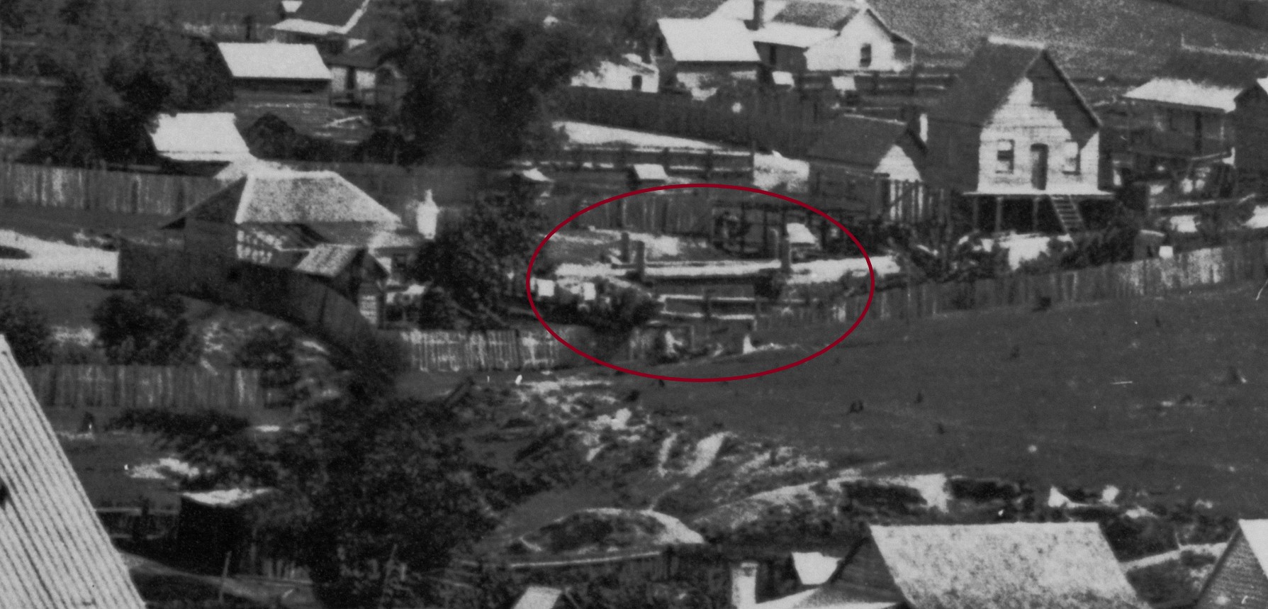
A few historic images show these watercourses. In the one below looking towards West End from Dornoch Terrace, the upper part of a creek is visible snaking down the hill between houses and passing under a small wooden bridge on Boundary Street (map reference 2). This area near today’s Baynes Street was known as “Sailor’s Gully”. The creek disappeared with drainage work completed in 1899.
A close up of the image above shows a bridge across the creek in Boundary Street near Spring Street, as well as the watercourse running along the location of the future Baynes Street.
The creek is described in a 1930 article about West End.
“A creek ran from the direction of Dornoch-terrace, down behind the West End police station, and past Wilson’s and Davidson’s to Melbourne-street. There were several small bridges or culverts in the locality. From time to time, the creek became flooded and encroached on the track. It was deep in places, and after heavy rain many good hen-coops, boilers, and tubs were washed down towards the reservoir at the corner of Melbourne and Manning streets, where water was once sold at 5 shillings a cask.”

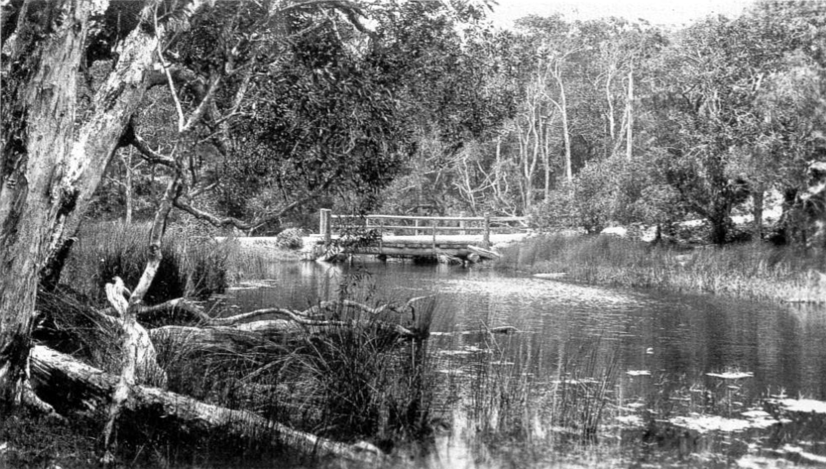
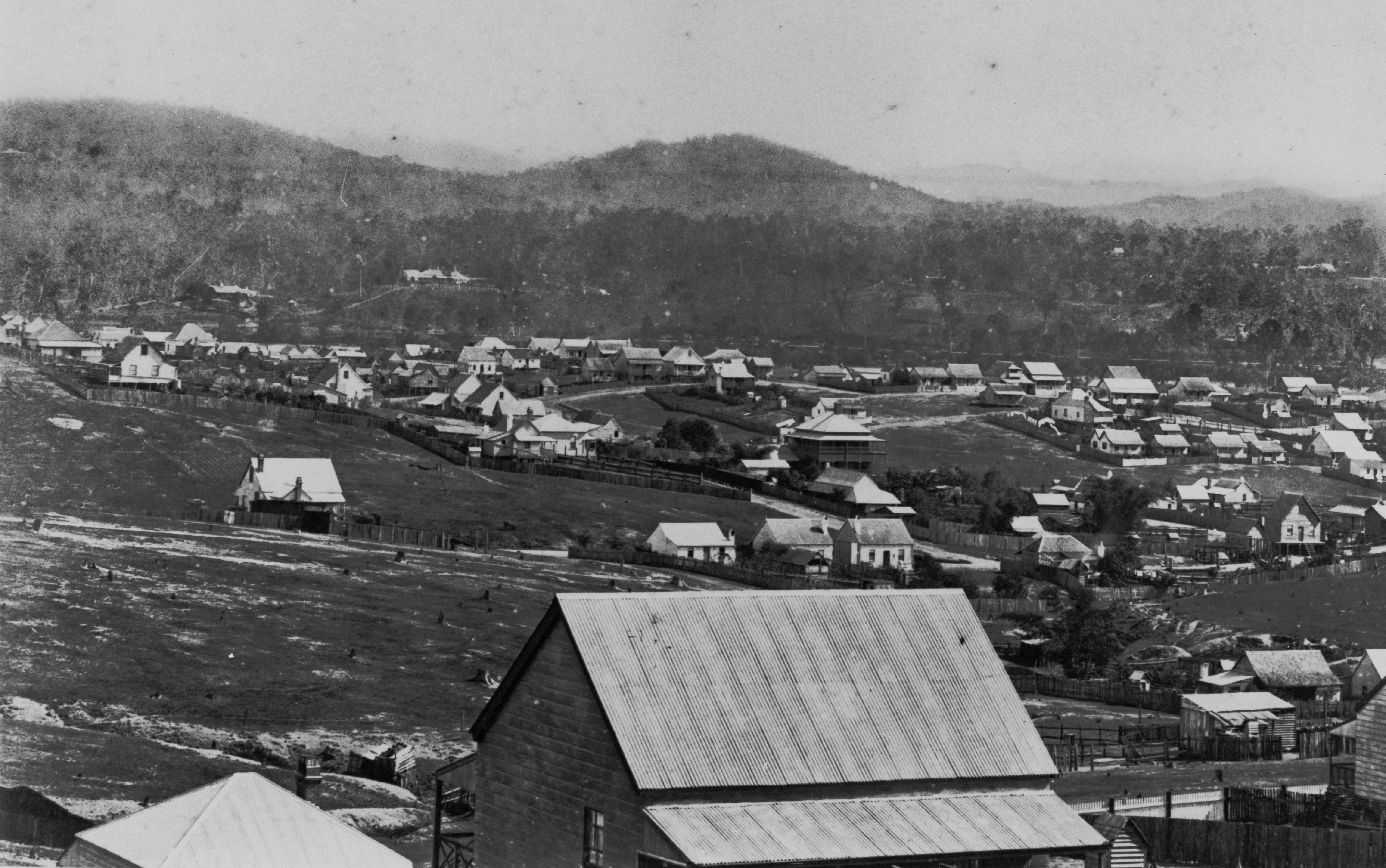
In the photo below, taken from the summit of Highgate Hill looking north, another creek is visible. It ran through a culvert under Gladstone Road and down Brook Street to waterholes in the location of the Somerville House swimming pool. Nearby Dorchester Street was then called Water Street West.

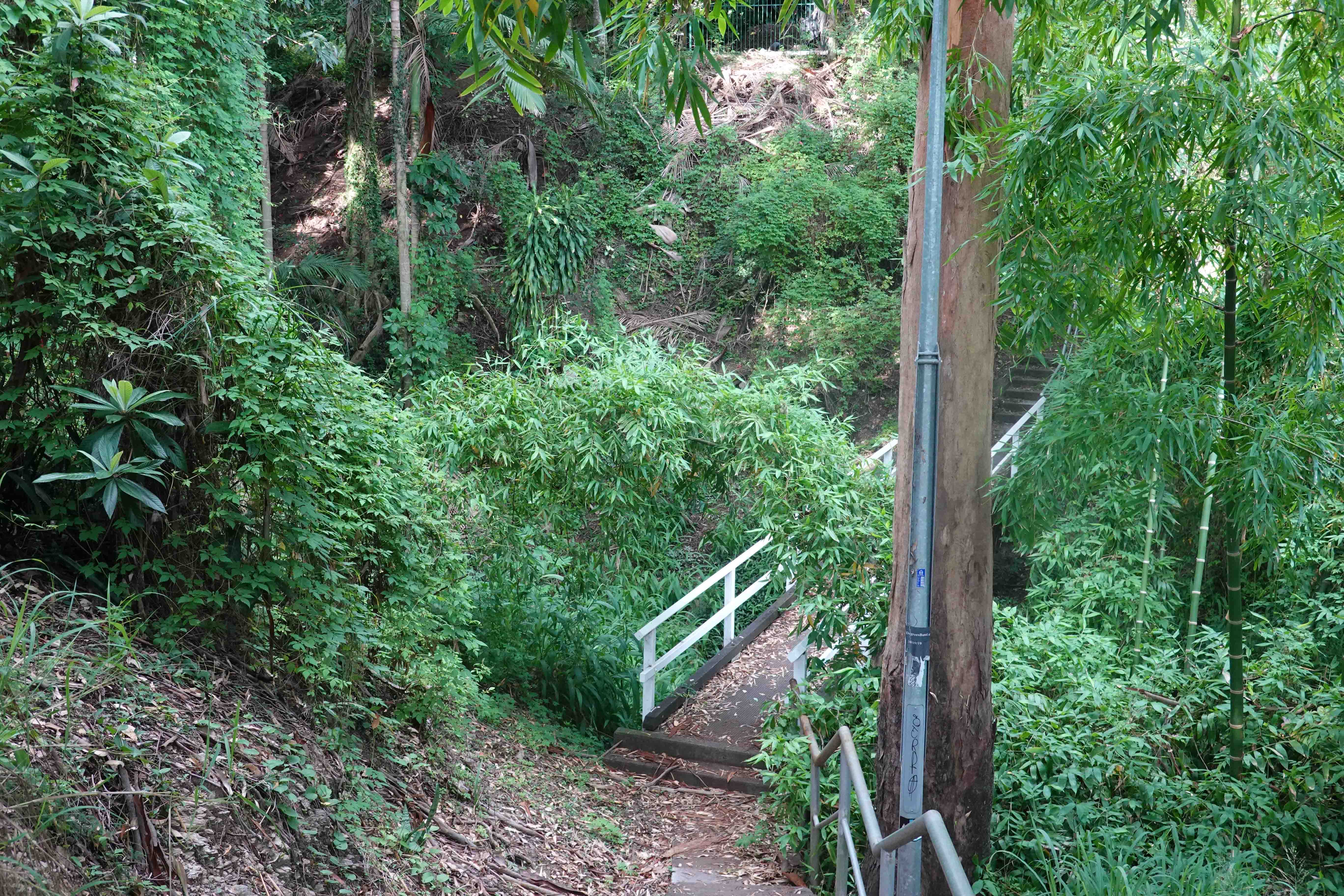
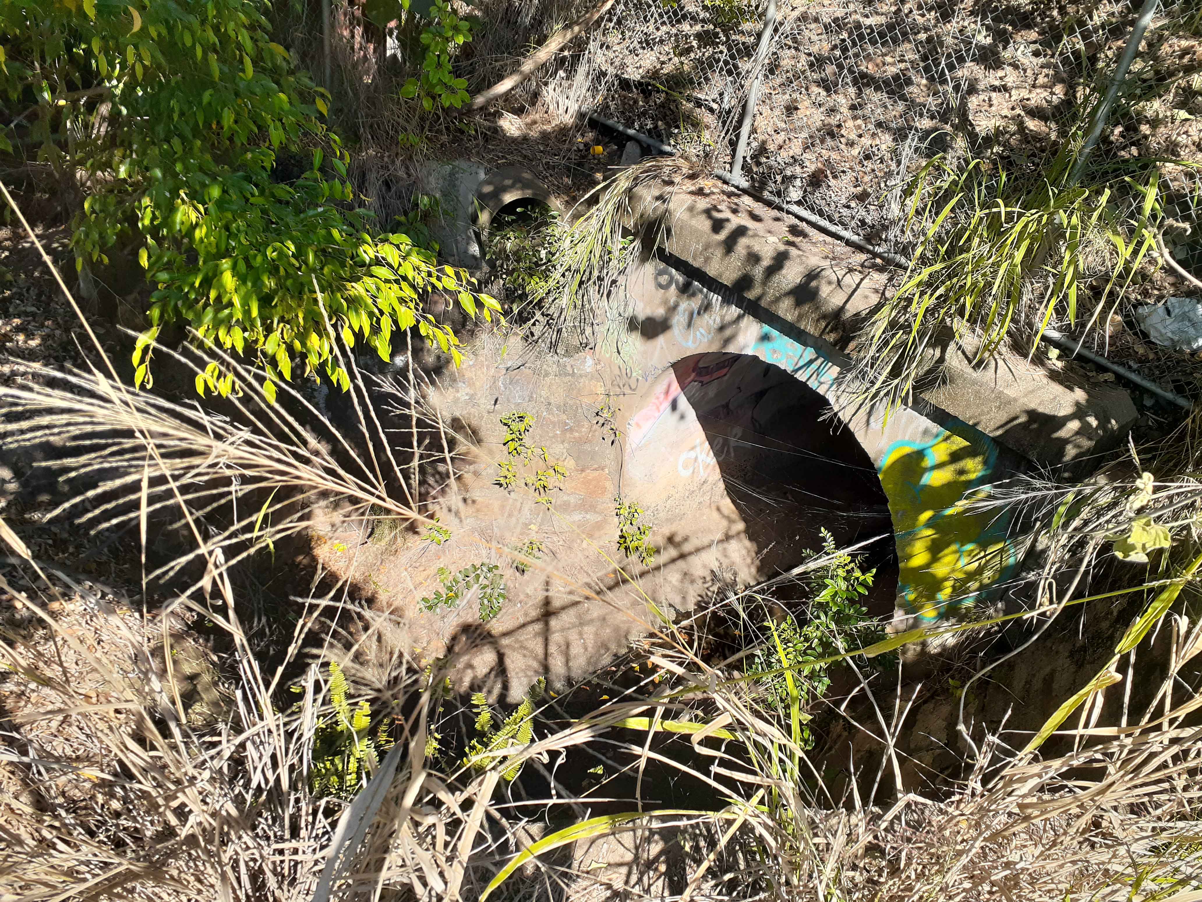
Walking around the area, it’s still possible to determine the approximate course of many of these watercourses. Here and there, there’s also a glimpse of running water.
Early water supply – “and not enough to drink”
With periods of low rainfall and no reticulation, obtaining sufficient water for household and industrial use was problematic. Houses commonly had wood shingle roofs which gave water collected in tanks an unpleasant taste.
One source was a spring in the creek running along Boundary Street opposite the Boundary Hotel. People came from miles around to collect water. After a spell of dry weather, there was a constant queue from morning to night. One resident remembered waiting for up to 2 hours to get a couple of buckets of water. Another writer recalled how Aboriginal people earned money by carrying full buckets to water casks at neighbourhood homes.
There was also a makeshift reservoir on the creek at the corner of Melbourne and Manning Streets, where water was sold by the land owner.
One resident commenting on this water in 1871 wrote “when brought home, and allowed a few hours to settle, it becomes clear as crystal, and far more pleasing to the taste than the Enoggera water, as delivered in North Brisbane.”
Even after the construction of Enoggera Dam in 1866, Southside residents still had to utilise waterholes and creeks, until a pipeline was laid across the river in 1869. By this time, the situation was becoming serious as there had been a prolonged drought.
This small pipeline of 1 1/2 inches ( approx. 4cm) in diameter, fed several ship’s tanks situated near the end of Ernest Street where water was sold by a licensee. It was turned on for several hours every day. The flow of water was low and ran “as if from the spout of a tea kettle”. The pipeline was frequently damaged by the anchors of ships.
Three years after the construction of the first permanent Victoria Bridge in 1874 (see my post The Fascinating Story of the First Victoria Bridge ), a 6 inch (15cm) pipeline was laid across it , initially feeding a tank situated on the corner of Melbourne and Stanley Streets. Subsequently, some reticulation to homes and businesses occurred and a second 9 inch (23cm) pipe later supplemented the supply.
The water pressure was low and there were outages as the bridge swung open to allow ships to pass, until it was permanently closed in 1885. The poor water supply on the Southside wasn’t resolved until the construction of a service reservoir near the top of Highgate Hill in 1889 (see my post Highgate Hill Reservoir 1889 ).
Roads
With so much low lying land and little drainage, many of the roads in the area became impassable after rain. A writer in 1880 described Melbourne Street.
“There is on the one side of the road a dangerous swamp, on the other a precipice, lined with thoroughly soaked clay, whereas the road, narrow as it is, is a chaos of bottomless mire.”
According to the reminisces of a South Brisbane resident in the 1860s, Russell Street was the main route to the West End area as Melbourne Street was “a very sloppy track”.
Steep creek gullies also presented difficulties. There was one running alongside Vulture Street near Hampstead Road that formed part of the system of watercourses descending to the Melbourne Street swamp. In 1883, a horse-drawn omnibus travelling to the city overturned down the gully. (Map reference 6)
After some 30 years of drainage work in South Brisbane, one writer was wondering in 1890 whether it was best to refer to Cordelia Street as a quagmire or a swamp.
Health concerns
It didn’t take long for the pristine wetlands of South Brisbane, which had provided a source of fresh water for tens of thousands of years, to become polluted. Natural watercourses were blocked or diverted, industry was established and rubbish dumped. The cause of many diseases was not known and there was a widespread belief that “Fever”, usually typhoid, was caused by miasma or the effects of breathing smelly vapours. The “night air” coming from rotting vegetation and foul water was avoided.
Whilst mistaken, at least the miasma theory led to a recognition that polluted water and poor sanitation presented a health risk.

There were cholera scares from time to time, but it was typhoid fever that caused many deaths in Brisbane. A major contributor was the dumping of night soil into watercourses, along with the blocking of the natural flow of water.
Following on from the work of Louis Pasteur in the 1880s, a vaccination for typhoid was developed in 1896. Typhoid persisted as a problem in Brisbane however into the 1940s.
Drainage work
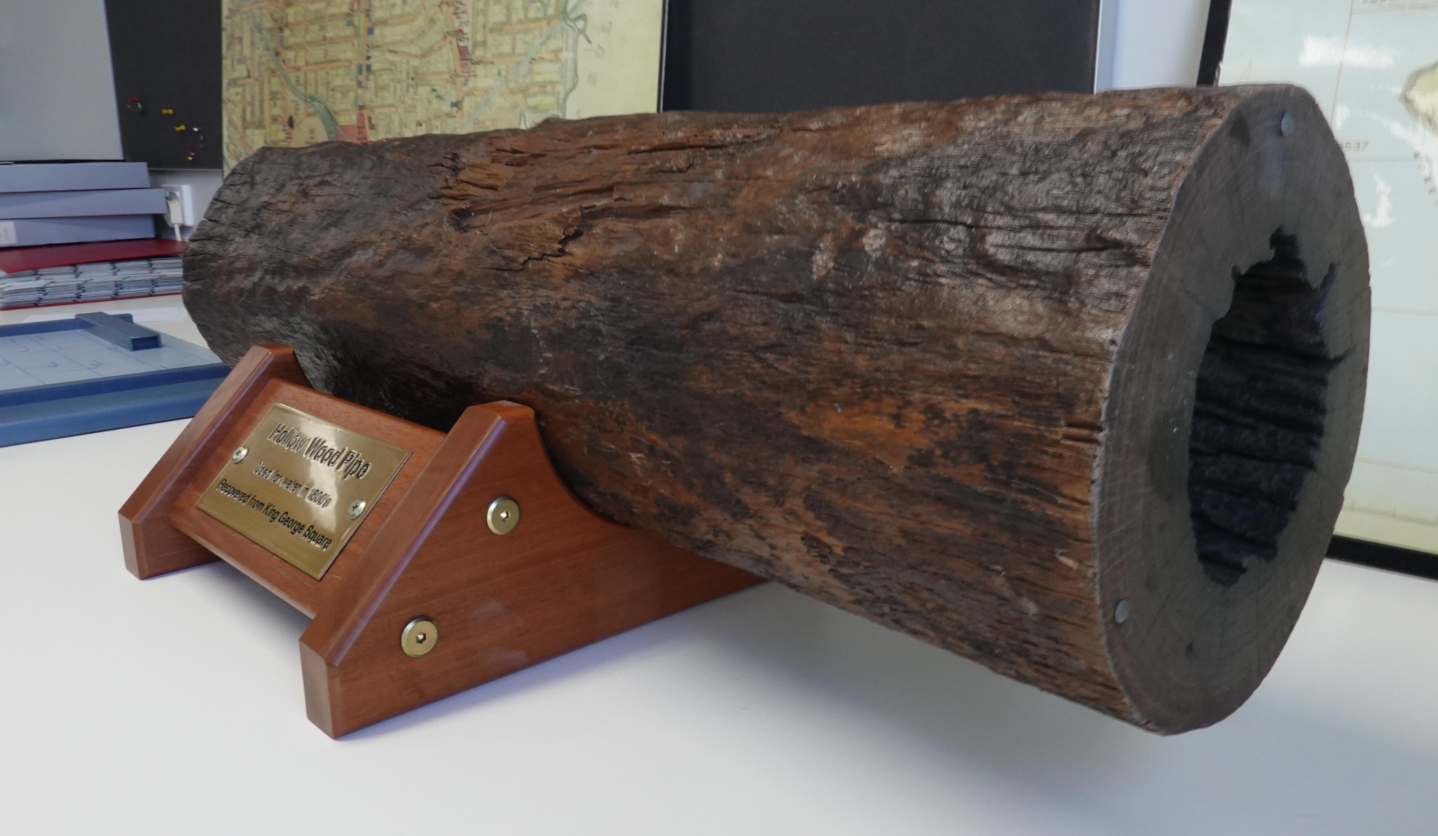
At the same time that the water supply was slowly improved, other work was underway to rid Kurilpa of unwanted polluted water. The drainage of creeks and swamps initially used hollowed out tree trunks, progressing to brick drains in later years.
Some examples will serve to illustrate the issues that arose.
South Brisbane Creek
A report in the Sydney Gazette of the first Moreton Bay land sale held in 1842 noted that “a number of these allotments, on the south side of the river, are situated in a swamp which is overflowed daily, at highwater” and opined that they were not suitable as building sites.
The South Brisbane creek contributed largely to the problem and in 1859 the Council decided to deepen it to prevent stagnant water forming. By 1861, a drain was planned. In a Council meeting, T. B. Stephens spoke about the area.
“This piece of land was a receptacle for mud, filth, and debris of all descriptions, and its presence had proved most detrimental to the health of the inhabitants of the locality, and deteriorated the value of property in the neighbourhood. The doctors had recommended numerous families to leave, so unwholesome was it rendered.”
In addition, Stanley and Glenelg Streets were covered with water during spring tides and after heavy rain.
In 1862, a barrel drain was constructed, running along the street to the river. The following year, two further drains were built. All this cost over £3,000, a large sum for the Council at that time.
Despite this expenditure, one correspondent to the Brisbane Courier some 4 years later wrote of “the many pestiferous pools of stagnant and putrid water” including a waterhole of around a half an acre at Russell Street “completely covered by a red, or rather purple, fungus” . The area near the corner of Grey and Glenelg Streets he described as “fully a quarter of a mile of half-dried marshy land, the receptacle of every kind of abomination”.
Further work was done over the years including a major drain down Melbourne Street with feeds from Vulture Street, costing almost £29,000. The perennially cash strapped South Brisbane Town Council was by then responsible. This very large expenditure was driven by fear of a cholera outbreak. A pandemic was raging and the ship “Dorunda” had brought infected people to Brisbane.
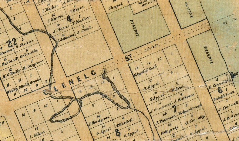
Musgrave Street and Kurilpa Swamp
A long waterhole located between the river and Montague Road was known as “Kurilpa Swamp” and alternatively as “Coombe’s Swamp” in early days ( see my post The Origins of Orleigh Park ). Reeds from here were said to have been used to thatch the roof of South Brisbane’s first shop.
The swamp was a source of controversy for many years. The water requirements of local residents and market gardeners conflicted with increasing health concerns, as the body of water became polluted. An 1884 proposal to drain the swamp met with a petition from local land owners, citing their need to use the water for household use in dry periods.
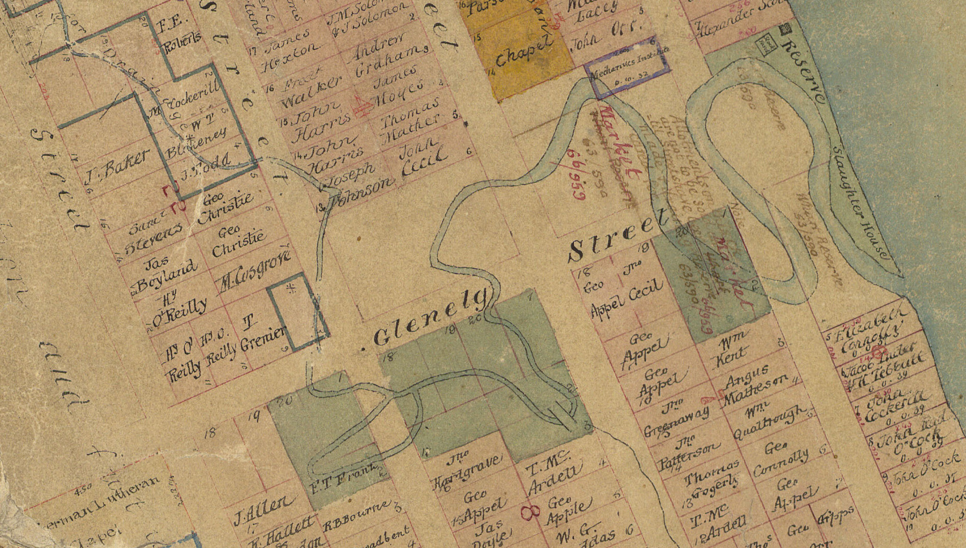
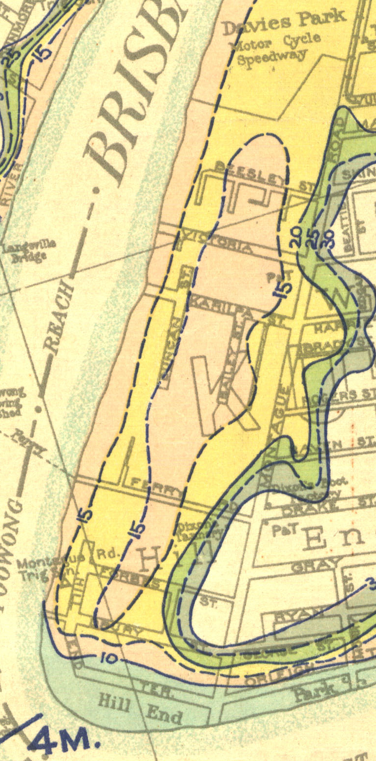
Drainage work was completed in nearby Musgrave Street in 1889, where a small creek that flowed from the swamp across what is now Davies Park flowed into the river. The plans for this work have survived and show the original water course, as well as the path of an earlier wooden drain.
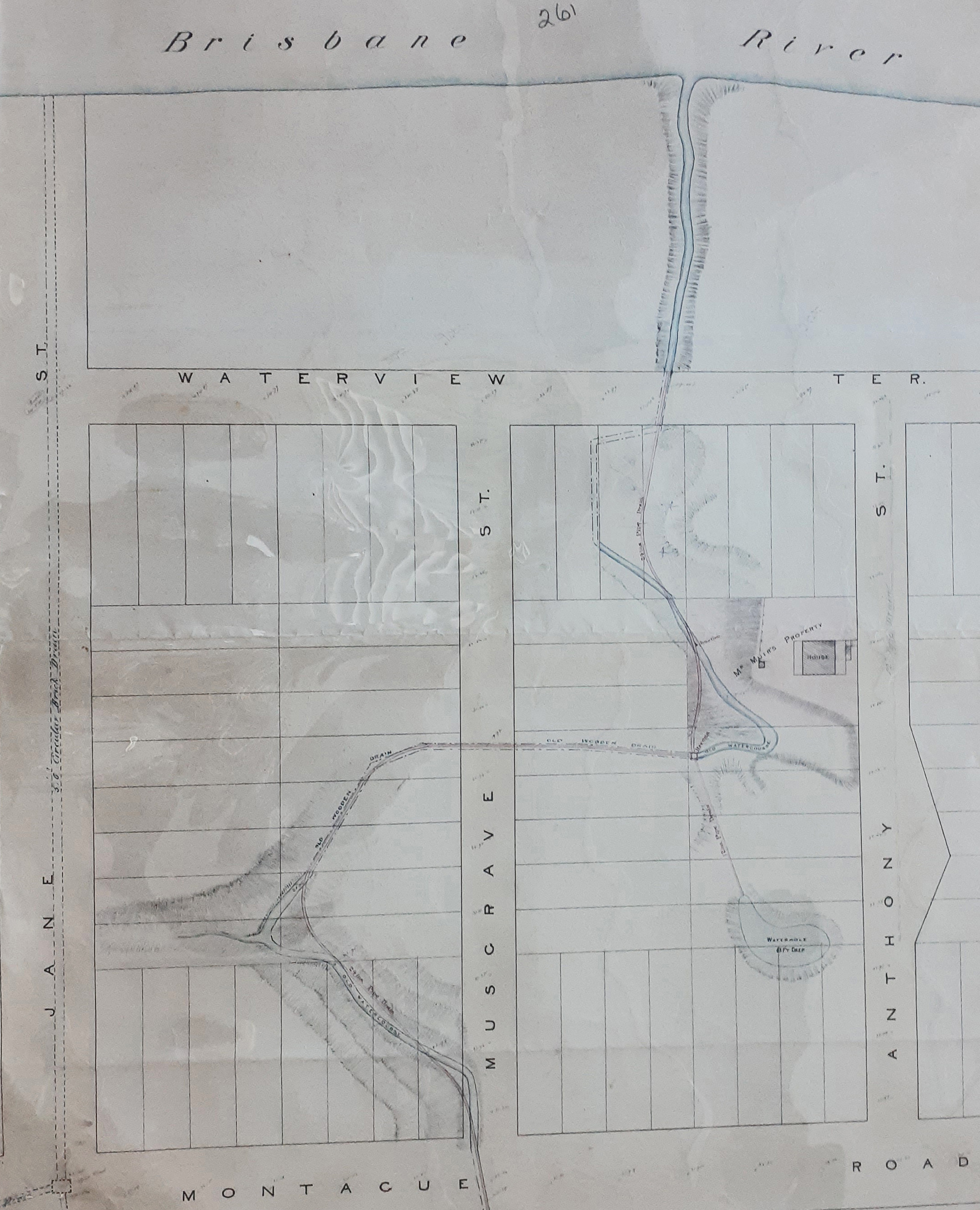
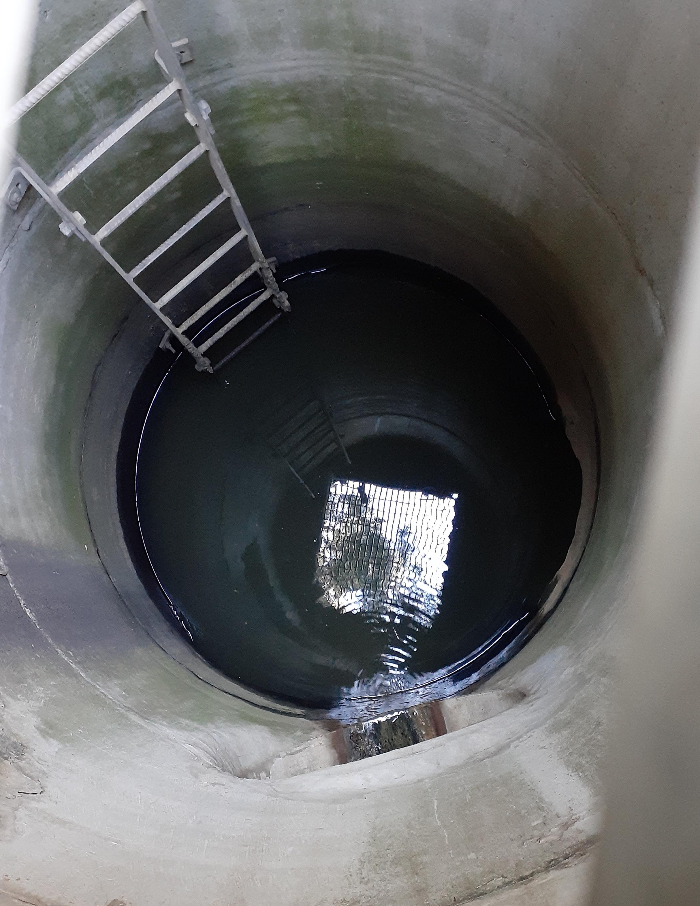
Waterview Terrace on the plan is now known as Buchanan Street. Running water is visible looking down an access point in the street. A few years ago during the construction of a residential tower here, pumps were working 24 hours a day with a continual flow of water into the river.
Concerns about the swamp continued to arise, and in 1896 an open drain down Kurilpa Street to reduce the depth of water was proposed.


In 1916, one nearby resident described the swamp as a “stinkpot and disease ridden inferno” and commented that “the water therein is covered with unhealthy looking green slime, which, to on amateur on sanitary science, looks bad and polluted”. He mentioned the recent death of his neighbour’s two children from typhoid fever. A 12 inch (30cm) pipe was run to the river in 1917, draining the swamp. At that time there was still a market garden using the water.
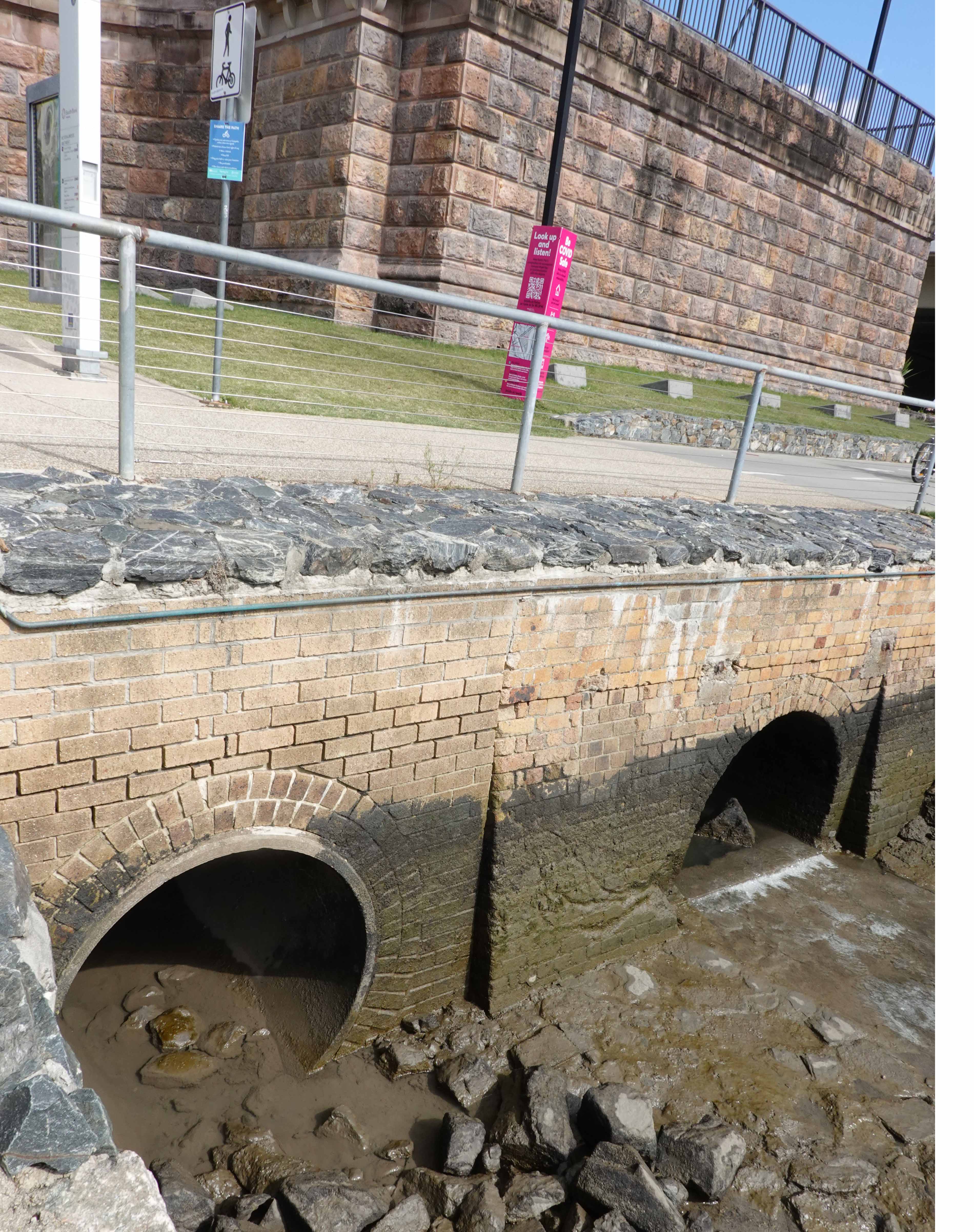
Walking along the riverside park today, some 14 storm water drains can be seen along this 1,300m section of the river, reflecting the amount of work that has been required over the years.
Floods
Despite continual drainage work, we have been frequently reminded of the low lying nature of the land by the numerous floods that have occurred. Some of the worst flooding has been in the low lying areas that were previously swamps, such as near the corner of Melbourne and Boundary Streets.
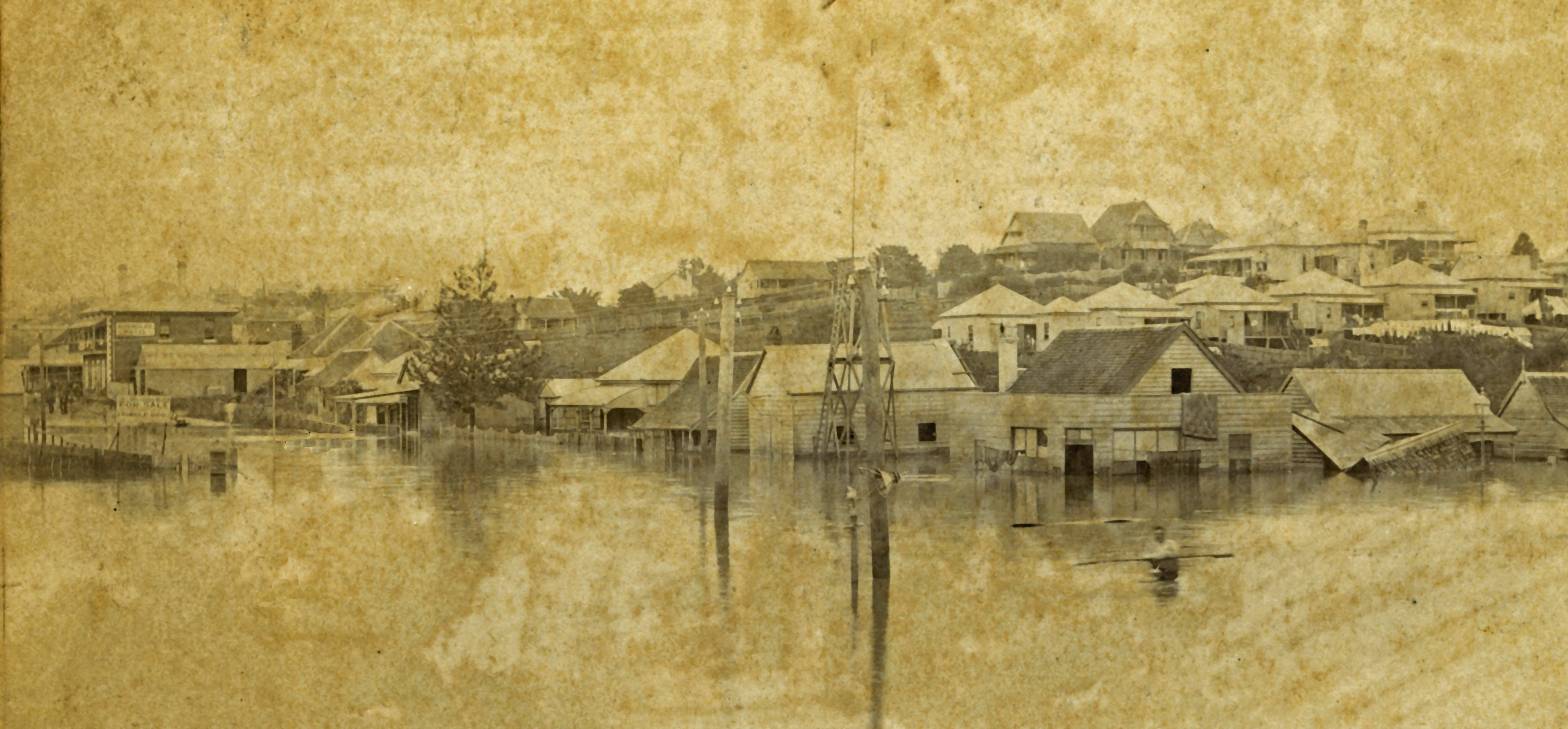
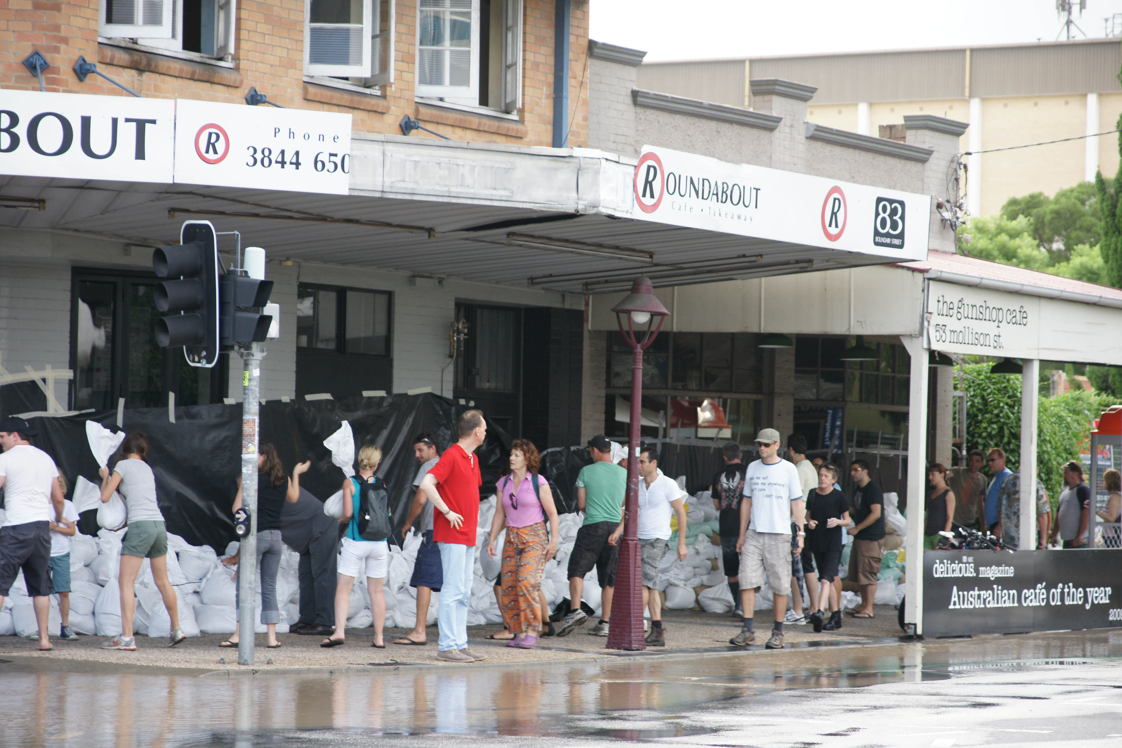
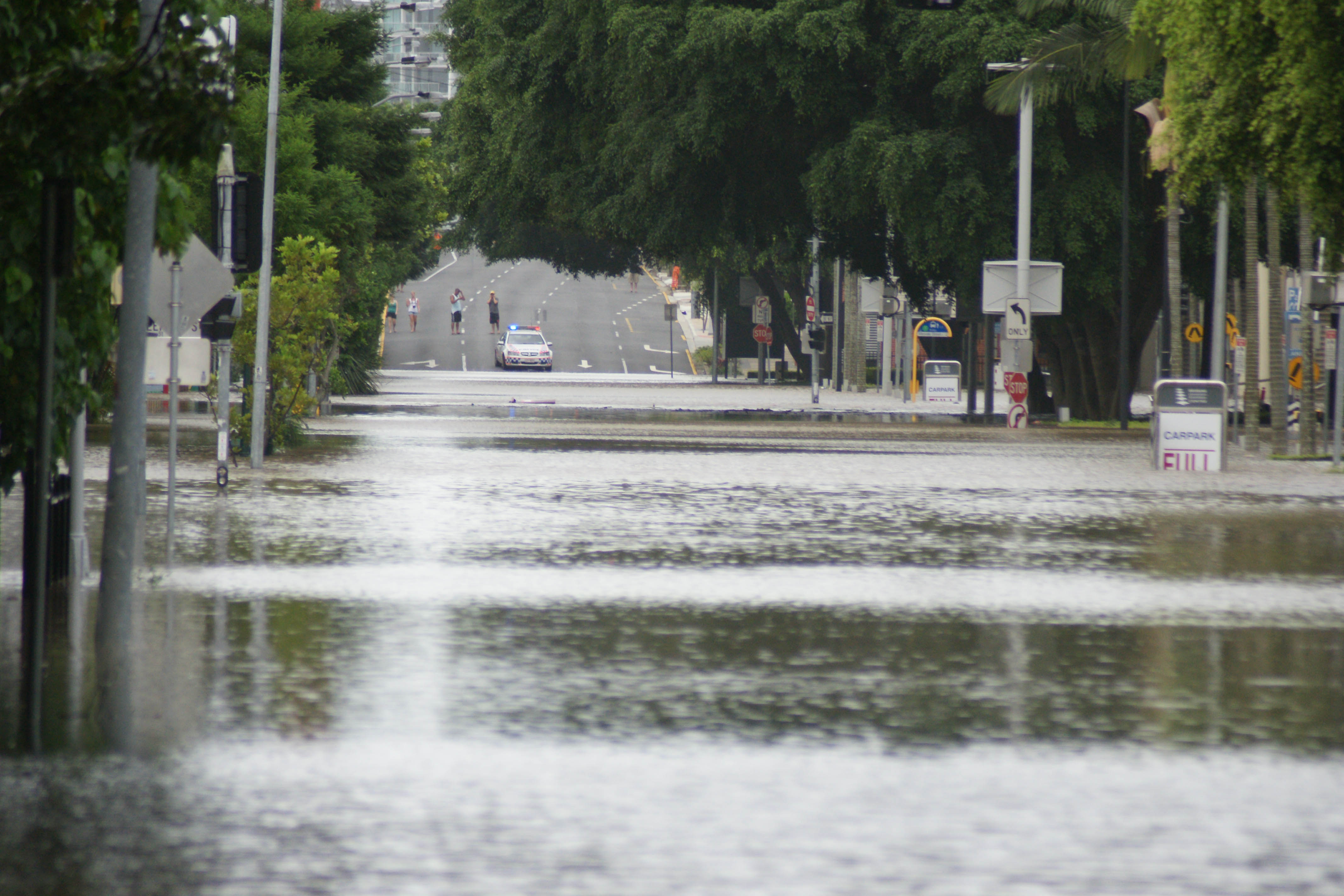
The images below from the 1893 and 2011 floods are reminders of the long swamp which ran along the south side of Melbourne Street.
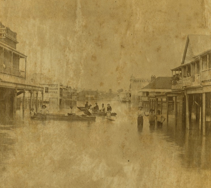
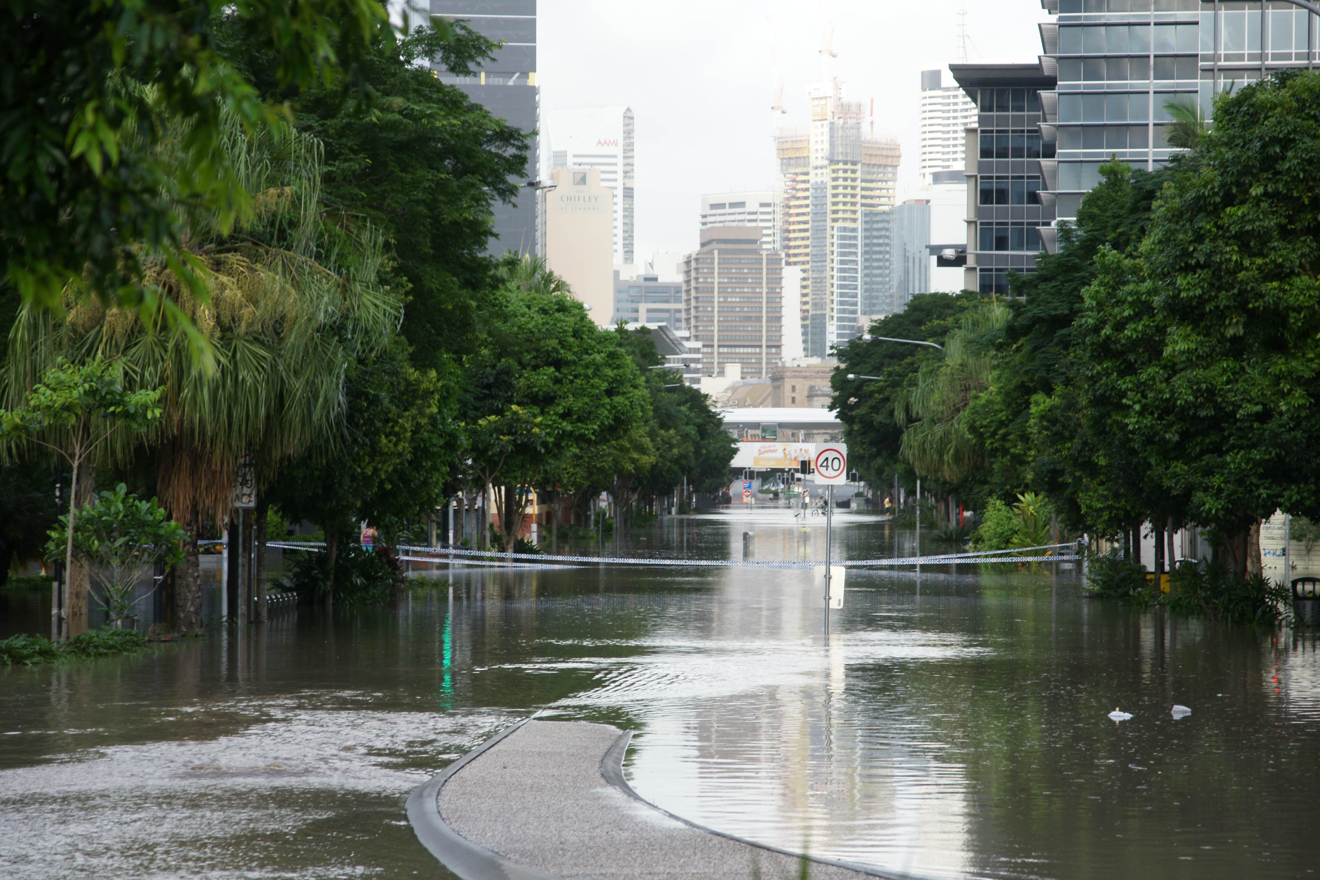
Flooding such as in 2011 also gives us an idea of how this swamp also extended down Merivale Street, ending in the South Brisbane creek. (map reference 9).
Today
Today this history of both too much and at the same time too little water is largely forgotten, except in times of heavy rain and flooding. If you live in the area, check the map of watercourses and swamps. You might be surprised, or perhaps not!
The numbers on the map below are references found through this post. Arrows indicate the viewpoint of images.

© P. Granville 2021-2023

Thanks so much for doing this research and making it accessible. As a long term local resident, I find this very interesting. I also now realise I am living in a swamp. Lol.
LikeLike
Thanks Bek. Since researching this post, I’ve been noticing tell tale signs of the past all over the place, eg. Properties much lower than the built up street marking an old water course .
LikeLike
Great work Paul. Apropos the comment about properties lower than the street levels. George Kassos once took me on a walk to point out the deep backyards of houses around Boundary and O’Connell Streets showing glimpses of the original contours of the land most likely evidence of creek lines. Fascinating. I lobbied Cr Sri at one stage to name the piece of parkland adjacent to the Pradella development Coombes Place or Coombes Swamp or similar. A reminder to us all of the land we’ve redesigned for our modern purposes.
LikeLike
Hi Steve thanks very much. yes once you start looking … There’s also been a lot of cutting. For example Hardgrave Road used to be a lot steeper. The top was shaved off and the material used to fill Vulture Street, which had quite a slope across the street. If you look at the yards of houses on Vulture between Hardgrave and Montague, you’ll see they’re a few metres below street level.
LikeLike
PS the Pradella development is right where the Winterbottoms had their omnibus stables. I wrote about them a few posts ago.
LikeLike
Pingback: Musgrave Park – The Early Days | Highgate Hill and Its History
Pingback: Vulture Street – From Dotted Line to Bitumen | Highgate Hill and Its History
Hi Paul, thank you for writing and collecting historical images of the land I am living on.
LikeLiked by 1 person
Paul, some people say the “kuril” = “rakali” = golden bellied water rat = Hydromys chrysogaster. The rate and elephanat bronze scuplture outside GOMA claims that.
LikeLike
Hi Jan they could be correct but I haven’t seen what information this is based on. Frederick Strange in 1854 noted that the Melomys cervinipes was called the ‘Corrill’ on Stradbroke Island lending weight to that interpretation.
LikeLike
A question for the historians.
LikeLike